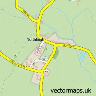
This Sidbury street map is a detailed vector street map covering a 750m x 750m area. Select a larger area to create and download your own vector street map of Sidbury.
The 750-metre map sample for Sidbury covers 171 mapped buildings and approximately 15.1 km of road detail, of which 11 named roads are named. The immediate area includes 1 school, 1 GP surgery within 2 miles, 1 pub and 1 MOT station, with 3 within 2 miles. The wider area around Sidbury features 2 food and drink venues, 1 hotel and 1 campsite within 2 miles. To create a larger or custom map of Sidbury, the map builder lets you define your own coverage area and download editable SVG, PDF and PNG files.
Create a larger editable map of Sidbury
Choose any area you need and generate a high-quality vector map instantly. Perfect for print, planning, design, business and personal use.

This Sidbury street map in Devon is available as downloadable SVG, PDF and PNG map files, or as a printed map for planning, business, display, education, local information and design work. You can also create a larger custom map area using the map selector.
What this Sidbury map sample shows
Sidbury lies within Sidmouth Cp parish, part of Sidmouth Rural ward in the East Devon District local authority area. The postcode geography for this area includes the EX postcode area, the EX10 postcode district and the EX10 0 postcode sector. Residents fall under the Nhs Devon Integrated Care Board for NHS services.
Local features near Sidbury
Within 2 milesAmenities and services in and around Sidbury.
Administrative and postcode information for Sidbury
Sidbury lies within Sidmouth Cp parish, part of Sidmouth Rural ward in the East Devon District local authority area. The postcode geography for this area includes the EX postcode area, the EX10 postcode district and the EX10 0 postcode sector. Residents fall under the Nhs Devon Integrated Care Board for NHS services.
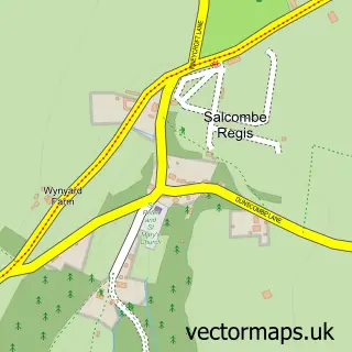
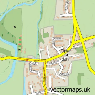
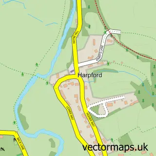
Nearby street map samples around Sidbury

More street maps in Devon
750 metre map area coverage
Boundary, postcode and point of interest information for the 750m x 750m rectangle centred on this sample map.
Boundaries containing map centre
Constituency: Honiton and Sidmouth Co Const
County: Devon County
District: East Devon District
Icb: NHS Devon ICB
Parish: Sidmouth CP
Police Force: devon and cornwall
Postcode District: EX10
Postcode Sector: EX10 0
Ward: Sidmouth Rural Ward
Nearby boundaries intersecting sample
No additional intersecting boundaries found.
Postcode coverage
POI category counts
Church Cathedral: 2
Elementary School: 2
Holiday Rental Home: 2
Post Office: 2
Anglican Church: 1
Bakery: 1
Bed And Breakfast: 1
Butcher Shop: 1
Car Rental Agency: 1
Coffee Shop: 1
Sample points of interest
- The Parish of St Giles Sidbury with St Peter Sidford
- Sweet Satisfaction
- Rose Cottage Guest House
- David Drew & Son
- Practical Car and Van Rental
- Sidbury Chapel
- St Giles Church
- Little Sands
- East Devon Locksmiths
- Sidbury C of E Primary School
- Sidbury Church of England Primary School
- Safe Harbour Holiday Cottage Sidmouth
Create a larger editable map of Sidbury
This sample shows only a 750 metre area. To create a larger map of Sidbury, use our map builder to choose your own coverage area, add titles and download editable SVG, PDF and PNG files.
Create a custom map of Sidbury