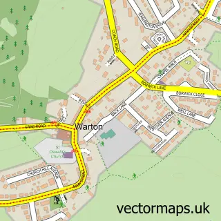
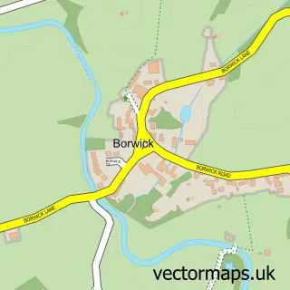
This Silverdale street map is a detailed vector street map covering a 750m x 750m area. Select a larger area to create and download your own vector street map of Silverdale.
The 750-metre map sample for Silverdale covers 231 mapped buildings and approximately 7.0 km of road detail, of which 15 named roads are named. The immediate area includes 2 schools, 4 pubs and 1 MOT station. The wider area around Silverdale features 2 tourism points of interest, 5 food and drink venues and 1 hotel. To create a larger or custom map of Silverdale, the map builder lets you define your own coverage area and download editable SVG, PDF and PNG files.
Create a larger editable map of Silverdale
Choose any area you need and generate a high-quality vector map instantly. Perfect for print, planning, design, business and personal use.

This Silverdale street map in Lancashire is available as downloadable SVG, PDF and PNG map files, or as a printed map for planning, business, display, education, local information and design work. You can also create a larger custom map area using the map selector.
What this Silverdale map sample shows
Silverdale lies within Silverdale Cp parish, part of Silverdale ward in the Lancaster District (B) local authority area. The postcode geography for this area includes the LA postcode area, the LA5 postcode district and the LA5 0 postcode sector. Residents fall under the Nhs Lancashire And South Cumbria Integrated Care Board for NHS services.
Local features near Silverdale
Within 2 milesAmenities and services in and around Silverdale.
Administrative and postcode information for Silverdale
The local authority covering Silverdale is Lancaster District (B), within the county of Lancashire. The settlement lies within Silverdale ward and Silverdale Cp civil parish. The LA5 postcode district and LA5 0 postcode sector serve the immediate area. NHS provision in the area is delivered through University Hospitals Of Morecambe Bay Nhs Foundation Trust.
Nearby street map samples around Silverdale

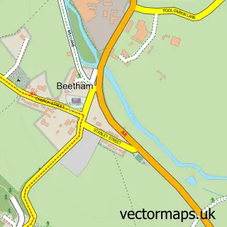
More street maps in Lancashire
750 metre map area coverage
Boundary, postcode and point of interest information for the 750m x 750m rectangle centred on this sample map.
Boundaries containing map centre
Constituency: Morecambe and Lunesdale Co Const
County: Lancashire County
District: Lancaster District (B)
Icb: NHS Lancashire and South Cumbria ICB
Parish: Silverdale CP
Police Force: lancashire
Postcode District: LA5
Postcode Sector: LA5 0
Ward: Silverdale Ward
Nearby boundaries intersecting sample
No additional intersecting boundaries found.
Postcode coverage
POI category counts
Pub: 4
Korean Grocery Store: 3
Antique Store: 2
Community Services Non Profits: 2
Landmark And Historical Building: 2
Professional Services: 2
Accommodation: 1
Adult Education: 1
Alternative Medicine: 1
Atms: 1
Sample points of interest
- West Lindeth Hall
- Maritas
- Sarah Fishwick Marketing
- Bricolage
- Vintage & Country
- The Cooperative Food Emsgate Lane - Silverdale, Silverdale
- NatWest Mobile Branch
- Silverdale Beach
- Hair By Jackie
- Martyn Bargh Joinery
- Alfresco Mobile Catering
- John Burrow Chimney Services
Create a larger editable map of Silverdale
This sample shows only a 750 metre area. To create a larger map of Silverdale, use our map builder to choose your own coverage area, add titles and download editable SVG, PDF and PNG files.
Create a custom map of Silverdale