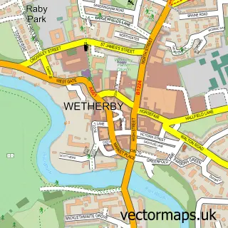
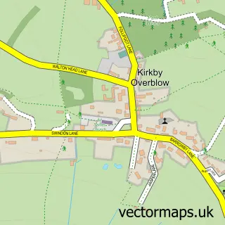
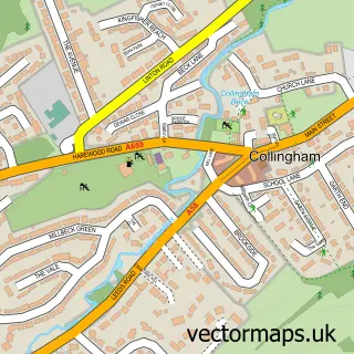
This Spofforth street map is a detailed vector street map covering a 750m x 750m area. Select a larger area to create and download your own vector street map of Spofforth.
The 750-metre map sample for Spofforth covers 338 mapped buildings and approximately 11.6 km of road detail, of which 25 named roads are named. The immediate area includes 1 school, 2 pubs and 1 MOT station within 2 miles. The wider area around Spofforth features 4 tourism points of interest and 2 food and drink venues. To create a larger or custom map of Spofforth, the map builder lets you define your own coverage area and download editable SVG, PDF and PNG files.
Create a larger editable map of Spofforth
Choose any area you need and generate a high-quality vector map instantly. Perfect for print, planning, design, business and personal use.

This Spofforth street map in North Yorkshire is available as downloadable SVG, PDF and PNG map files, or as a printed map for planning, business, display, education, local information and design work. You can also create a larger custom map area using the map selector.
What this Spofforth map sample shows
Spofforth lies within Spofforth With Stockeld Cp parish, part of Spofforth With Lower Wharfedale ward in the North Yorkshire local authority area. The postcode geography for this area includes the HG postcode area, the HG3 postcode district and the HG3 1 postcode sector. Residents fall under the Nhs Humber And North Yorkshire Integrated Care Board for NHS services.
Local features near Spofforth
Within 2 milesAmenities and services in and around Spofforth.
Administrative and postcode information for Spofforth
The local authority covering Spofforth is North Yorkshire, within the county of North Yorkshire. The settlement lies within Spofforth With Lower Wharfedale ward and Spofforth With Stockeld Cp civil parish. The HG3 postcode district and HG3 1 postcode sector serve the immediate area. NHS provision in the area is delivered through Harrogate And District Nhs Foundation Trust.
Nearby street map samples around Spofforth

More street maps in North Yorkshire
750 metre map area coverage
Boundary, postcode and point of interest information for the 750m x 750m rectangle centred on this sample map.
Boundaries containing map centre
Constituency: Wetherby and Easingwold Co Const
District: North Yorkshire
Icb: NHS Humber and North Yorkshire ICB
Parish: Spofforth with Stockeld CP
Police Force: north yorkshire
Postcode District: HG3
Postcode Sector: HG3 1
Nearby boundaries intersecting sample
No additional intersecting boundaries found.
Postcode coverage
POI category counts
Anglican Church: 2
Convenience Store: 2
Elementary School: 2
Furniture Repair: 2
Landmark And Historical Building: 2
Pub: 2
Agriculture: 1
Antique Store: 1
Architect: 1
Beauty Salon: 1
Sample points of interest
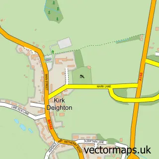
- Spofforth Forge
- All Saints Church
- Spofforth, Kirk Deighton, Follifoot and Little Ribston
- Antique-Violin
- Parker Beevers
- No. 19 Treatment Room
- Twenty24 BMX Magazine
- Spofforth Castle
- Malvern Events
- The Liquorice Shop
- Practical Solutions
- Londis
Create a larger editable map of Spofforth
This sample shows only a 750 metre area. To create a larger map of Spofforth, use our map builder to choose your own coverage area, add titles and download editable SVG, PDF and PNG files.
Create a custom map of Spofforth