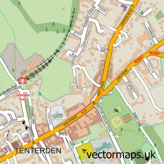
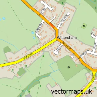
This St Michaels street map is a detailed vector street map covering a 750m x 750m area. Select a larger area to create and download your own vector street map of St Michaels.
The 750-metre map sample for St Michaels covers 523 mapped buildings and approximately 16.5 km of road detail, of which 21 named roads are named. The immediate area includes 1 GP surgery within 2 miles, 2 pubs and 1 MOT station within 2 miles. The wider area around St Michaels features 4 food and drink venues. To create a larger or custom map of St Michaels, the map builder lets you define your own coverage area and download editable SVG, PDF and PNG files.
Create a larger editable map of St Michaels
Choose any area you need and generate a high-quality vector map instantly. Perfect for print, planning, design, business and personal use.

This St Michaels street map in Kent is available as downloadable SVG, PDF and PNG map files, or as a printed map for planning, business, display, education, local information and design work. You can also create a larger custom map area using the map selector.
What this St Michaels map sample shows
St Michaels lies within Tenterden Cp parish, part of Tenterden St Michael's ward in the Ashford District (B) local authority area. The postcode geography for this area includes the TN postcode area, the TN30 postcode district and the TN30 6 postcode sector. Residents fall under the Nhs Kent And Medway Integrated Care Board for NHS services.
Local features near St Michaels
Within 2 milesAmenities and services in and around St Michaels.
Administrative and postcode information for St Michaels
The local authority covering St Michaels is Ashford District (B), within the county of Kent. The settlement lies within Tenterden St Michael's ward and Tenterden Cp civil parish. The TN30 postcode district and TN30 6 postcode sector serve the immediate area. NHS provision in the area is delivered through East Kent Hospitals University Nhs Foundation Trust.
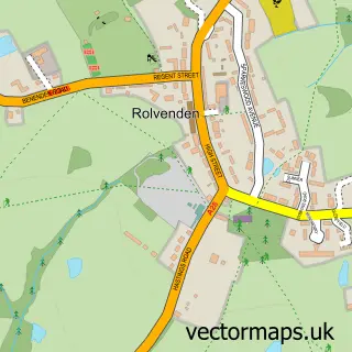
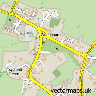
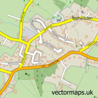
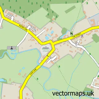
Nearby street map samples around St Michaels

More street maps in Kent
750 metre map area coverage
Boundary, postcode and point of interest information for the 750m x 750m rectangle centred on this sample map.
Boundaries containing map centre
Constituency: Weald of Kent Co Const
County: Kent County
District: Ashford District (B)
Icb: NHS Kent and Medway ICB
Parish: Tenterden CP
Police Force: kent
Postcode District: TN30
Postcode Sector: TN30 6
Ward: Tenterden St. Michael's Ward
Nearby boundaries intersecting sample
Ward: Rolvenden & Tenterden West Ward, Tenterden North Ward
Postcode coverage
POI category counts
Convenience Store: 5
Fish And Chips Restaurant: 4
Gas Station: 4
Beauty Salon: 3
Building Supply Store: 3
Package Locker: 3
Construction Services: 2
Fast Food Restaurant: 2
Pub: 2
Web Designer: 2
Sample points of interest
- Forensic Marketing
- Helen France
- Astra Trading
- Neil K Chapman
- Happy Valley Tenterden
- ESSO St.Michaels (Rontec - CZC), St. Michaels
- Myview
- Carol's Hair Design
- Skindeep Laser Clinic
- The Salon
- J Peachey
- Mint Fresh Services
Create a larger editable map of St Michaels
This sample shows only a 750 metre area. To create a larger map of St Michaels, use our map builder to choose your own coverage area, add titles and download editable SVG, PDF and PNG files.
Create a custom map of St Michaels