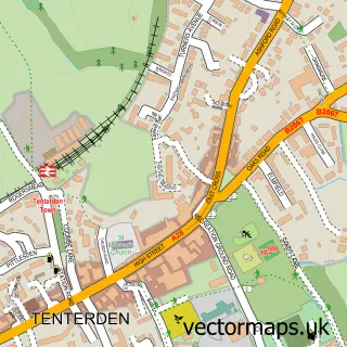
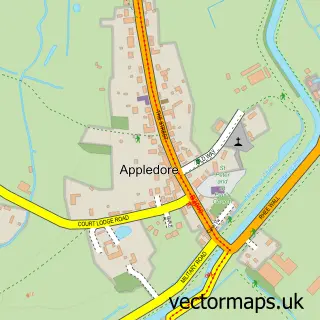
This Woodchurch street map is a detailed vector street map covering a 750m x 750m area. Select a larger area to create and download your own vector street map of Woodchurch.
The 750-metre map sample for Woodchurch covers 255 mapped buildings and approximately 14.1 km of road detail, of which 11 named roads are named. The immediate area includes 1 school, 1 GP surgery within 2 miles, 2 pubs and 1 MOT station. The wider area around Woodchurch features 3 food and drink venues. To create a larger or custom map of Woodchurch, the map builder lets you define your own coverage area and download editable SVG, PDF and PNG files.
Create a larger editable map of Woodchurch
Choose any area you need and generate a high-quality vector map instantly. Perfect for print, planning, design, business and personal use.

This Woodchurch street map in Kent is available as downloadable SVG, PDF and PNG map files, or as a printed map for planning, business, display, education, local information and design work. You can also create a larger custom map area using the map selector.
What this Woodchurch map sample shows
Woodchurch lies within Woodchurch Cp parish, part of Weald South ward in the Ashford District (B) local authority area. The postcode geography for this area includes the TN postcode area, the TN26 postcode district and the TN26 3 postcode sector. Residents fall under the Nhs Kent And Medway Integrated Care Board for NHS services.
Local features near Woodchurch
Within 2 milesAmenities and services in and around Woodchurch.
Administrative and postcode information for Woodchurch
The local authority covering Woodchurch is Ashford District (B), within the county of Kent. The settlement lies within Weald South ward and Woodchurch Cp civil parish. The TN26 postcode district and TN26 3 postcode sector serve the immediate area. NHS provision in the area is delivered through East Kent Hospitals University Nhs Foundation Trust.
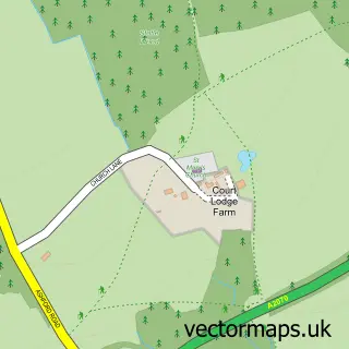
Nearby street map samples around Woodchurch


More street maps in Kent
750 metre map area coverage
Boundary, postcode and point of interest information for the 750m x 750m rectangle centred on this sample map.
Boundaries containing map centre
Constituency: Weald of Kent Co Const
County: Kent County
District: Ashford District (B)
Icb: NHS Kent and Medway ICB
Parish: Woodchurch CP
Police Force: kent
Postcode District: TN26
Postcode Sector: TN26 3
Ward: Weald South Ward
Nearby boundaries intersecting sample
No additional intersecting boundaries found.
Postcode coverage
POI category counts
Church Cathedral: 2
Pub: 2
Scout Hall: 2
Auto Detailing: 1
Automotive: 1
Automotive Repair: 1
Business Consulting: 1
Butcher Shop: 1
Carpenter: 1
Coffee Shop: 1
Sample points of interest
- A Clean Vehicle Detailing
- BCS Celular
- Woodchurch Garage
- The Business Intelligence Network
- Carley Butchers
- Nicholls Restores
- All Saints Church
- Outpost Church
- The Old Post Office Coffee Shop
- Woodchurch Memorial Hall
- Post Office Travel Money
- Woodchurch Church of England Primary School
Create a larger editable map of Woodchurch
This sample shows only a 750 metre area. To create a larger map of Woodchurch, use our map builder to choose your own coverage area, add titles and download editable SVG, PDF and PNG files.
Create a custom map of Woodchurch