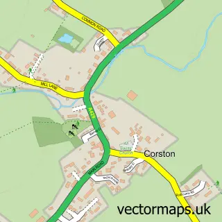
This Stanton St Quintin street map is a detailed vector street map covering a 750m x 750m area. Select a larger area to create and download your own vector street map of Stanton St Quintin.
The 750-metre map sample for Stanton St Quintin covers 116 mapped buildings and approximately 9.8 km of road detail, of which 6 named roads are named. The immediate area includes 1 school and 2 MOT stations within 2 miles. The wider area around Stanton St Quintin features 4 food and drink venues and 1 hotel. To create a larger or custom map of Stanton St Quintin, the map builder lets you define your own coverage area and download editable SVG, PDF and PNG files.
Create a larger editable map of Stanton St Quintin
Choose any area you need and generate a high-quality vector map instantly. Perfect for print, planning, design, business and personal use.

This Stanton St Quintin street map in Wiltshire is available as downloadable SVG, PDF and PNG map files, or as a printed map for planning, business, display, education, local information and design work. You can also create a larger custom map area using the map selector.
What this Stanton St Quintin map sample shows
Stanton St Quintin lies within Stanton St. Quintin Cp parish, part of Kington ward in the Wiltshire local authority area. The postcode geography for this area includes the SN postcode area, the SN14 postcode district and the SN14 6 postcode sector. Residents fall under the Nhs Bath And North East Somerset, Swindon And Wiltshire Integrated Care Board for NHS services.
Local features near Stanton St Quintin
Within 2 milesAmenities and services in and around Stanton St Quintin.
Administrative and postcode information for Stanton St Quintin
Stanton St Quintin lies within Stanton St. Quintin Cp parish, part of Kington ward in the Wiltshire local authority area. The postcode geography for this area includes the SN postcode area, the SN14 postcode district and the SN14 6 postcode sector. Residents fall under the Nhs Bath And North East Somerset, Swindon And Wiltshire Integrated Care Board for NHS services.
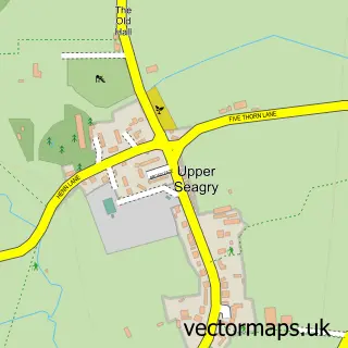
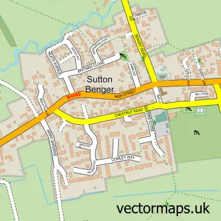
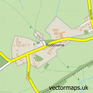
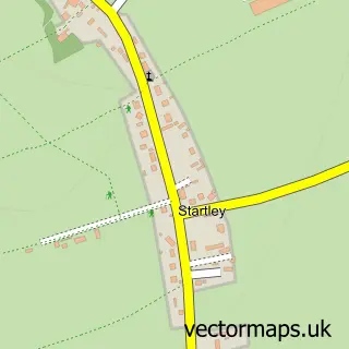
Nearby street map samples around Stanton St Quintin

More street maps in Wiltshire
750 metre map area coverage
Boundary, postcode and point of interest information for the 750m x 750m rectangle centred on this sample map.
Boundaries containing map centre
Constituency: South Cotswolds Co Const
District: Wiltshire
Icb: NHS Bath and North East Somerset Swindon and Wiltshire ICB
Parish: Stanton St. Quintin CP
Police Force: wiltshire
Postcode District: SN14
Postcode Sector: SN14 6
Nearby boundaries intersecting sample
No additional intersecting boundaries found.
Postcode coverage
POI category counts
Restaurant: 3
Anglican Church: 1
Atms: 1
Coffee Shop: 1
Elementary School: 1
Hotel: 1
Naturopathic Holistic: 1
Rental Kiosks: 1
Retail: 1
Sample points of interest
- St Giles Stanton St Quintin
- Barclays ATM
- Costa Express
- Stanton St Quintin Primary and Nursery School
- Stanton Manor Hotel
- Carol Plumridge Osteopathy Ltd
- Motor Fuel Group @ Stanon St. Quintin
- Afternoon Tea at the Gallery Restaurant, Stanton Manor
- Sunday Lunch at the Gallery Restaurant, Stanton Manor
- The Gallery Restaurant at Stanton Manor
- Bob Ritchie
Create a larger editable map of Stanton St Quintin
This sample shows only a 750 metre area. To create a larger map of Stanton St Quintin, use our map builder to choose your own coverage area, add titles and download editable SVG, PDF and PNG files.
Create a custom map of Stanton St Quintin