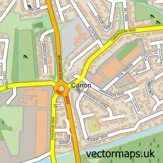
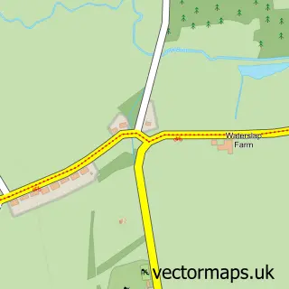
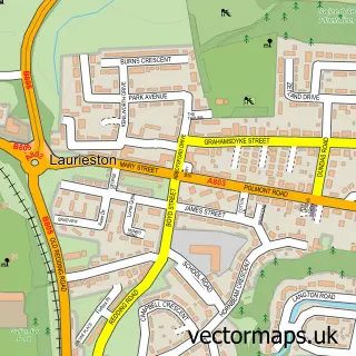
This Stenhousemuir street map is a detailed vector street map covering a 750m x 750m area. Select a larger area to create and download your own vector street map of Stenhousemuir.
The 750-metre map sample for Stenhousemuir covers 406 mapped buildings and approximately 18.2 km of road detail, of which 31 named roads are named. The immediate area includes 5 GP surgeries, with 9 within 2 miles, 3 pubs and 1 MOT station, with 15 within 2 miles. The wider area around Stenhousemuir features 4 tourism points of interest, 5 food and drink venues and 1 hotel. To create a larger or custom map of Stenhousemuir, the map builder lets you define your own coverage area and download editable SVG, PDF and PNG files.
Create a larger editable map of Stenhousemuir
Choose any area you need and generate a high-quality vector map instantly. Perfect for print, planning, design, business and personal use.

This Stenhousemuir street map in Stirling and Falkirk is available as downloadable SVG, PDF and PNG map files, or as a printed map for planning, business, display, education, local information and design work. You can also create a larger custom map area using the map selector.
What this Stenhousemuir map sample shows
Stenhousemuir lies within Falkirk parish, part of Bonnybridge And Larbert ward in the Falkirk local authority area. The postcode geography for this area includes the FK postcode area, the FK5 postcode district and the FK5 3 postcode sector. Residents fall under the Forth Valley for NHS services.
Local features near Stenhousemuir
Within 2 milesAmenities and services in and around Stenhousemuir.
Administrative and postcode information for Stenhousemuir
Stenhousemuir lies within Falkirk parish, part of Bonnybridge And Larbert ward in the Falkirk local authority area. The postcode geography for this area includes the FK postcode area, the FK5 postcode district and the FK5 3 postcode sector. Residents fall under the Forth Valley for NHS services.
Nearby street map samples around Stenhousemuir

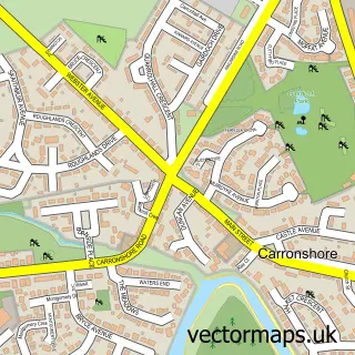
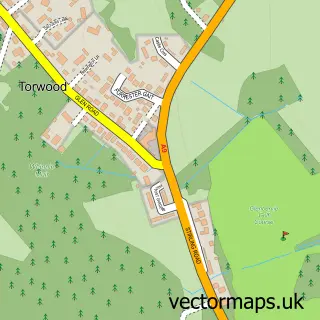
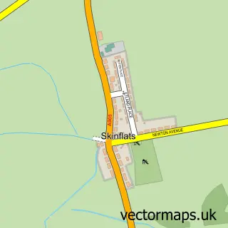
More street maps in Stirling and Falkirk
750 metre map area coverage
Boundary, postcode and point of interest information for the 750m x 750m rectangle centred on this sample map.
Boundaries containing map centre
Constituency: Alloa and Grangemouth Co Const
District: Falkirk
Icb: Forth Valley
Postcode District: FK5
Postcode Sector: FK5 4
Ward: Carse, Kinnaird and Tryst Ward
Nearby boundaries intersecting sample
Postcode Sector: FK5 3
Postcode coverage
POI category counts
Pharmacy: 6
Beauty Salon: 4
Convenience Store: 4
Dentist: 4
Fast Food Restaurant: 4
Barber: 3
Betting Center: 3
Doctor: 3
Eyewear And Optician: 3
Family Practice: 3
Sample points of interest
- Enjoy-a-Ball Falkirk
- British Red Cross
- Cairn Housing Association
- Craegmoor Health Care
- Neil Hart Electrical Ltd.
- MOTOROBEX
- JK Tyres and Autocentre
- Greggs
- RBS
- Clydesdale Bank
- Gents At 244
- Paul Surgeon Barbers 2
Create a larger editable map of Stenhousemuir
This sample shows only a 750 metre area. To create a larger map of Stenhousemuir, use our map builder to choose your own coverage area, add titles and download editable SVG, PDF and PNG files.
Create a custom map of Stenhousemuir