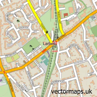
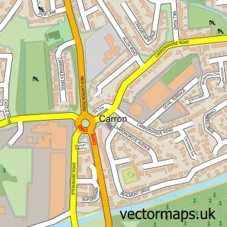
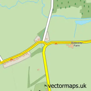
This Torwood street map is a detailed vector street map covering a 750m x 750m area. Select a larger area to create and download your own vector street map of Torwood.
The 750-metre map sample for Torwood covers 130 mapped buildings and approximately 7.8 km of road detail, of which 5 named roads are named. The immediate area includes 1 GP surgery within 2 miles and 5 MOT stations within 2 miles. To create a larger or custom map of Torwood, the map builder lets you define your own coverage area and download editable SVG, PDF and PNG files.
Create a larger editable map of Torwood
Choose any area you need and generate a high-quality vector map instantly. Perfect for print, planning, design, business and personal use.

This Torwood street map in Stirling and Falkirk is available as downloadable SVG, PDF and PNG map files, or as a printed map for planning, business, display, education, local information and design work. You can also create a larger custom map area using the map selector.
What this Torwood map sample shows
Torwood lies within Falkirk parish, part of Bonnybridge And Larbert ward in the Falkirk local authority area. The postcode geography for this area includes the FK postcode area, the FK5 postcode district and the FK5 4 postcode sector. Residents fall under the Forth Valley for NHS services.
Local features near Torwood
Within 2 milesAmenities and services in and around Torwood.
Administrative and postcode information for Torwood
Torwood lies within Falkirk parish, part of Bonnybridge And Larbert ward in the Falkirk local authority area. The postcode geography for this area includes the FK postcode area, the FK5 postcode district and the FK5 4 postcode sector. Residents fall under the Forth Valley for NHS services.
Nearby street map samples around Torwood

More street maps in Stirling and Falkirk
750 metre map area coverage
Boundary, postcode and point of interest information for the 750m x 750m rectangle centred on this sample map.
Boundaries containing map centre
Constituency: Alloa and Grangemouth Co Const
District: Falkirk
Icb: Forth Valley
Postcode District: FK5
Postcode Sector: FK5 4
Ward: Bonnybridge and Larbert Ward
Nearby boundaries intersecting sample
No additional intersecting boundaries found.
Postcode coverage
POI category counts
Beauty Salon: 2
It Service And Computer Repair: 2
Scout Hall: 2
Veterinarian: 1
Sample points of interest
- Block Mary
- Sparkle Nail & Beauty Room by Arlene Miller
- Brockie Web Design
- Castle-Computers
- 2nd Torwood Scout Group
- Falkirk - Forth and Union Unit
- VP Dog Grooming
Create a larger editable map of Torwood
This sample shows only a 750 metre area. To create a larger map of Torwood, use our map builder to choose your own coverage area, add titles and download editable SVG, PDF and PNG files.
Create a custom map of Torwood