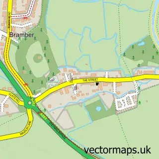
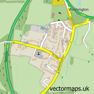
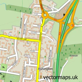
This Steyning street map is a detailed vector street map covering a 750m x 750m area. Select a larger area to create and download your own vector street map of Steyning.
The 750-metre map sample for Steyning covers 397 mapped buildings and approximately 15.0 km of road detail, of which 32 named roads are named. The immediate area includes 1 school, 1 GP surgery, 3 pubs and 1 MOT station. The wider area around Steyning features 3 tourism points of interest and 5 food and drink venues. To create a larger or custom map of Steyning, the map builder lets you define your own coverage area and download editable SVG, PDF and PNG files.
Create a larger editable map of Steyning
Choose any area you need and generate a high-quality vector map instantly. Perfect for print, planning, design, business and personal use.

This Steyning street map in West Sussex is available as downloadable SVG, PDF and PNG map files, or as a printed map for planning, business, display, education, local information and design work. You can also create a larger custom map area using the map selector.
What this Steyning map sample shows
Steyning lies within Steyning Cp parish, part of Steyning & Ashurst ward in the Horsham District local authority area. The postcode geography for this area includes the BN postcode area, the BN44 postcode district and the BN44 3 postcode sector. Residents fall under the Nhs Sussex Integrated Care Board for NHS services.
Local features near Steyning
Within 2 milesAmenities and services in and around Steyning.
Administrative and postcode information for Steyning
The local authority covering Steyning is Horsham District, within the county of West Sussex. The settlement lies within Steyning & Ashurst ward and Steyning Cp civil parish. The BN44 postcode district and BN44 3 postcode sector serve the immediate area. NHS provision in the area is delivered through University Hospitals Sussex Nhs Foundation Trust.
Nearby street map samples around Steyning

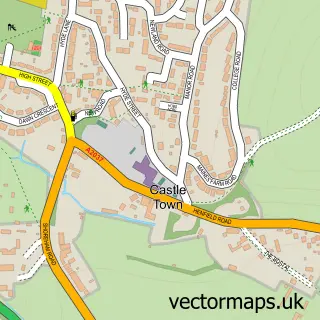
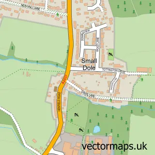
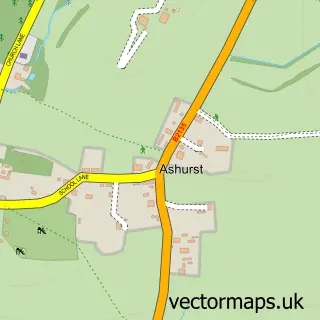
More street maps in West Sussex
750 metre map area coverage
Boundary, postcode and point of interest information for the 750m x 750m rectangle centred on this sample map.
Boundaries containing map centre
Constituency: Arundel and South Downs Co Const
County: West Sussex County
District: Horsham District
Icb: NHS Surrey and Sussex ICB
Parish: Steyning CP
Police Force: sussex
Postcode District: BN44
Postcode Sector: BN44 3
Ward: Steyning & Ashurst Ward
Nearby boundaries intersecting sample
No additional intersecting boundaries found.
Postcode coverage
POI category counts
Dentist: 7
Professional Services: 7
Real Estate Agent: 7
Church Cathedral: 5
Alternative Medicine: 4
Building Supply Store: 4
Convenience Store: 4
Flowers And Gifts Shop: 4
Hair Salon: 4
Bakery: 3
Sample points of interest
- Beltons Public Accountants
- Chimera Communications
- Imax Design & Print
- Karen Dennis Clairvoyant Medium/Tarot Reader & Reiki Master
- Lemongrass Bespoke Massage
- Steyning Osteopathic Clinic
- Steyning Osteopathic Services
- St Andrew and St Cuthman
- Vintage Looks
- King & Chasemore
- Folkes Architects
- Architecture by Jake
Create a larger editable map of Steyning
This sample shows only a 750 metre area. To create a larger map of Steyning, use our map builder to choose your own coverage area, add titles and download editable SVG, PDF and PNG files.
Create a custom map of Steyning