Vector Maps logo
Home Why it works Popular maps Districts Samples Customizer Create Your Map
VectorMaps.uk
Home Popular maps Districts Samples Customizer Create Your Map Privacy Disclaimer
Home / UK Maps / Northamptonshire / Stoke Albany Map

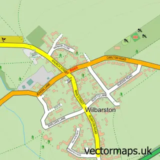
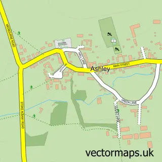
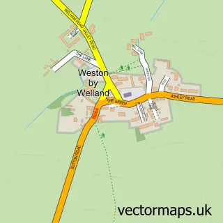
This Stoke Albany street map is a detailed vector street map covering a 750m x 750m area. Select a larger area to create and download your own vector street map of Stoke Albany.

Stoke Albany is a village in Northamptonshire, in the East Midlands of England. The settlement falls within the Kettering parliamentary constituency. It is served by the LE16 postcode district, with LE16 8 as the local postcode sector.

The 750-metre map sample for Stoke Albany covers 143 mapped buildings and approximately 20.6 km of road detail, of which 12 named roads are named. To create a larger or custom map of Stoke Albany, the map builder lets you define your own coverage area and download editable SVG, PDF and PNG files.

143Buildings
20.59 kmRoads
12Named roads
671Residents within 2 miles
Create your own

Create a larger editable map of Stoke Albany

Choose any area you need and generate a high-quality vector map instantly. Perfect for print, planning, design, business and personal use.

Choose any location
Editable SVG files
Any size up to A0
PDF, PNG & more
Instant download
High quality guaranteed
Create My Custom Map
Secure, private & no credit card required
Stoke Albany Vector Street Map
750m Sample
Stoke Albany vector street map sample showing roads, buildings and local features in a 750 metre preview area
Buy Stoke Albany Map Print from £12.95 Buy Stoke Albany Digital Map from £6

This Stoke Albany street map in Northamptonshire is available as downloadable SVG, PDF and PNG map files, or as a printed map for planning, business, display, education, local information and design work. You can also create a larger custom map area using the map selector.

What this Stoke Albany map sample shows

Stoke Albany lies within Stoke Albany Cp parish, part of Welland ward in the North Northamptonshire local authority area. The postcode geography for this area includes the LE postcode area, the LE16 postcode district and the LE16 8 postcode sector. Residents fall under the Nhs Northamptonshire Integrated Care Board for NHS services.

Administrative and postcode information for Stoke Albany

The local authority covering Stoke Albany is North Northamptonshire, within the county of Northamptonshire. The settlement lies within Welland ward and Stoke Albany Cp civil parish. The LE16 postcode district and LE16 8 postcode sector serve the immediate area. NHS provision in the area is delivered through Kettering General Hospital Nhs Foundation Trust.

Parish Stoke Albany CP
Ward Welland
District / local authority North Northamptonshire
County Northamptonshire
Historic county Northamptonshire
Postcode district LE16
Postcode sector LE16 8
Parliamentary constituency Kettering
Region East Midlands
Country England

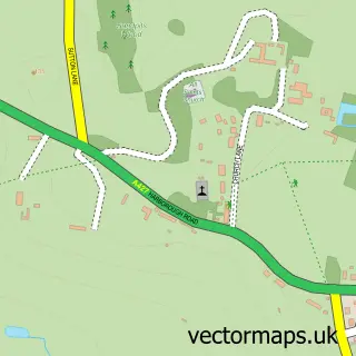
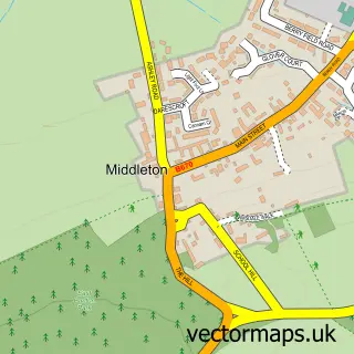
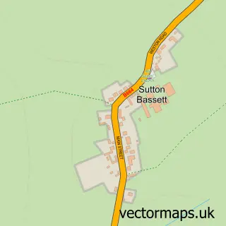
Nearby street map samples around Stoke Albany

Street map sample of Desborough, Northamptonshire Desborough Town - Northamptonshire - 2.9 miles Street map sample of Leicester, Leicestershire Leicester City - Leicestershire - 17.0 miles Street map sample of Wilbarston, Northamptonshire Wilbarston Village - Northamptonshire - 0.5 miles Street map sample of Brampton Ash, Northamptonshire Brampton Ash Village - Northamptonshire - 1.0 miles Street map sample of East Carlton, Northamptonshire East Carlton Village - Northamptonshire - 1.6 miles Street map sample of Ashley, Northamptonshire Ashley Village - Northamptonshire - 1.9 miles Street map sample of Dingley, Northamptonshire Dingley Village - Northamptonshire - 2.3 miles Street map sample of Middleton, Northamptonshire Middleton Village - Northamptonshire - 2.4 miles Street map sample of Sutton Bassett, Northamptonshire Sutton Bassett Village - Northamptonshire - 2.6 miles Street map sample of Weston by Welland, Northamptonshire Weston by Welland Village - Northamptonshire - 2.7 miles

More street maps in Northamptonshire

Street map sample of Wilbarston, Northamptonshire Wilbarston Village - 0.5 miles Street map sample of Brampton Ash, Northamptonshire Brampton Ash Village - 1.0 miles Street map sample of East Carlton, Northamptonshire East Carlton Village - 1.6 miles Street map sample of Ashley, Northamptonshire Ashley Village - 1.9 miles Street map sample of Dingley, Northamptonshire Dingley Village - 2.3 miles

750 metre map area coverage

Boundary, postcode and point of interest information for the 750m x 750m rectangle centred on this sample map.

Boundaries containing map centre

Constituency: Kettering Co Const

District: North Northamptonshire

Icb: NHS Northamptonshire ICB

Parish: Stoke Albany CP

Police Force: northamptonshire

Postcode District: LE16

Postcode Sector: LE16 8

Ward: Desborough Ward

Nearby boundaries intersecting sample

Parish: Wilbarston CP

Postcode coverage

LE16 LE16 8

POI category counts

Professional Services: 2

Anglican Church: 1

Community Center: 1

Construction Services: 1

Event Planning: 1

Gastropub: 1

Inn: 1

Marketing Agency: 1

Motorcycle Dealer: 1

Playground: 1

Sample points of interest

  • St Botolph Anglican Church
  • Stoke Albany Village Hall Community Center
  • L S P Builders Construction Services
  • The Old Course Event Planning
  • The White Horse Gastropub
  • White Horse Inn Inn
  • The Bestof Market Harborough Marketing Agency
  • G Tec Performance Motorcycle Dealer
  • Stoke Albany Play Park Playground
  • Stoke Albany Storage & Offices Professional Services
  • Stoke Albany Village Hall Professional Services
  • See Be Wellbeing Reflexology

Create a larger editable map of Stoke Albany

This sample shows only a 750 metre area. To create a larger map of Stoke Albany, use our map builder to choose your own coverage area, add titles and download editable SVG, PDF and PNG files.

Create a custom map of Stoke Albany

Phone 01751 473136 | Copyright Vectormaps.uk 2026

Samples Customizer Privacy Disclaimer
Stoke Albany Vector Street Map
Stoke Albany enlarged street map sample showing a 750 metre preview area