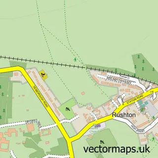
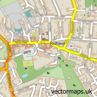
This Desborough street map is a detailed vector street map covering a 750m x 750m area. Select a larger area to create and download your own vector street map of Desborough.
The 750-metre map sample for Desborough covers 523 mapped buildings and approximately 33.2 km of road detail, of which 34 named roads are named. The immediate area includes 2 schools, 1 GP surgery within 2 miles and 1 MOT station, with 5 within 2 miles. The wider area around Desborough features 3 tourism points of interest and 1 food and drink venue. To create a larger or custom map of Desborough, the map builder lets you define your own coverage area and download editable SVG, PDF and PNG files.
Create a larger editable map of Desborough
Choose any area you need and generate a high-quality vector map instantly. Perfect for print, planning, design, business and personal use.

This Desborough street map in Northamptonshire is available as downloadable SVG, PDF and PNG map files, or as a printed map for planning, business, display, education, local information and design work. You can also create a larger custom map area using the map selector.
What this Desborough map sample shows
Desborough lies within Desborough Cp parish, part of Desborough Loatland ward in the North Northamptonshire local authority area. The postcode geography for this area includes the NN postcode area, the NN14 postcode district and the NN14 2 postcode sector. Residents fall under the Nhs Northamptonshire Integrated Care Board for NHS services.
Local features near Desborough
Within 2 milesAmenities and services in and around Desborough.
Administrative and postcode information for Desborough
Desborough lies within Desborough Cp parish, part of Desborough Loatland ward in the North Northamptonshire local authority area. The postcode geography for this area includes the NN postcode area, the NN14 postcode district and the NN14 2 postcode sector. Residents fall under the Nhs Northamptonshire Integrated Care Board for NHS services.
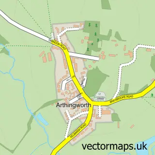
Nearby street map samples around Desborough

More street maps in Northamptonshire
750 metre map area coverage
Boundary, postcode and point of interest information for the 750m x 750m rectangle centred on this sample map.
Boundaries containing map centre
Constituency: Kettering Co Const
District: North Northamptonshire
Icb: NHS Northamptonshire ICB
Parish: Desborough CP
Police Force: northamptonshire
Postcode District: NN14
Postcode Sector: NN14 2
Ward: Desborough Ward
Nearby boundaries intersecting sample
No additional intersecting boundaries found.
Postcode coverage
POI category counts
Building Supply Store: 4
Printing Services: 3
Automotive Repair: 2
Elementary School: 2
Flowers And Gifts Shop: 2
Funeral Services And Cemeteries: 2
Grocery Store: 2
Park: 2
Pet Groomer: 2
Photography Store And Services: 2
Sample points of interest
- Priority Management Central
- EJM Motors
- Kings Car Repairs
- Desborough Baptist Church
- The Beauty Shed Desborough
- Desborough Town Bowling Club
- DKS Pest Control
- E P Mills Roofing Ltd
- Northamptonshire Windows & Conservatories
- Yorks Pest Control
- Letsmakeithappen
- M B Carpets
Create a larger editable map of Desborough
This sample shows only a 750 metre area. To create a larger map of Desborough, use our map builder to choose your own coverage area, add titles and download editable SVG, PDF and PNG files.
Create a custom map of Desborough