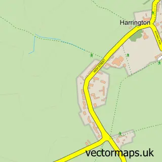
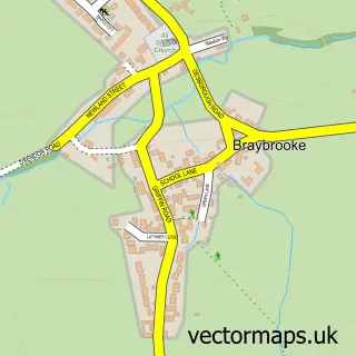
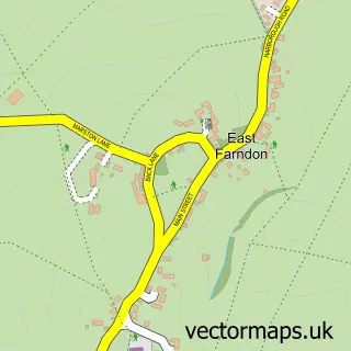
This Arthingworth street map is a detailed vector street map covering a 750m x 750m area. Select a larger area to create and download your own vector street map of Arthingworth.
The 750-metre map sample for Arthingworth covers 108 mapped buildings and approximately 14.6 km of road detail, of which 6 named roads are named. The immediate area includes 2 pubs and 1 MOT station within 2 miles. The wider area around Arthingworth features 2 food and drink venues. To create a larger or custom map of Arthingworth, the map builder lets you define your own coverage area and download editable SVG, PDF and PNG files.
Create a larger editable map of Arthingworth
Choose any area you need and generate a high-quality vector map instantly. Perfect for print, planning, design, business and personal use.

This Arthingworth street map in Northamptonshire is available as downloadable SVG, PDF and PNG map files, or as a printed map for planning, business, display, education, local information and design work. You can also create a larger custom map area using the map selector.
What this Arthingworth map sample shows
Arthingworth lies within Arthingworth Cp parish, part of Welford ward in the West Northamptonshire local authority area. The postcode geography for this area includes the LE postcode area, the LE16 postcode district and the LE16 8 postcode sector. Residents fall under the Nhs Northamptonshire Integrated Care Board for NHS services.
Local features near Arthingworth
Within 2 milesAmenities and services in and around Arthingworth.
Administrative and postcode information for Arthingworth
The local authority covering Arthingworth is West Northamptonshire, within the county of Northamptonshire. The settlement lies within Welford ward and Arthingworth Cp civil parish. The LE16 postcode district and LE16 8 postcode sector serve the immediate area. NHS provision in the area is delivered through Kettering General Hospital Nhs Foundation Trust.
Nearby street map samples around Arthingworth

More street maps in Northamptonshire
750 metre map area coverage
Boundary, postcode and point of interest information for the 750m x 750m rectangle centred on this sample map.
Boundaries containing map centre
Constituency: Daventry Co Const
District: West Northamptonshire
Icb: NHS Northamptonshire ICB
Parish: Arthingworth CP
Police Force: northamptonshire
Postcode District: LE16
Postcode Sector: LE16 8
Ward: Rural North East Ward
Nearby boundaries intersecting sample
No additional intersecting boundaries found.
Postcode coverage
POI category counts
Pub: 2
Anglican Church: 1
Automotive Repair: 1
Bicycle Shop: 1
Business Manufacturing And Supply: 1
Church Cathedral: 1
Health And Medical: 1
Pet Store: 1
Rv Rentals: 1
Sample points of interest
- St Andrew's, Arthingworth
- Hwt Mobile Car Valeting
- Brampton Valley Cycle Surgery
- Jet Pumps (UK)
- St Andrew's Church
- Dallas Burston Ashbourne
- New Beginnings Dog Training Club
- The Bull's Head
- The Bulls Head Arthingworth
- Tortoise Travel
Create a larger editable map of Arthingworth
This sample shows only a 750 metre area. To create a larger map of Arthingworth, use our map builder to choose your own coverage area, add titles and download editable SVG, PDF and PNG files.
Create a custom map of Arthingworth