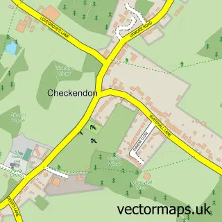
This Stoke Row street map is a detailed vector street map covering a 750m x 750m area. Select a larger area to create and download your own vector street map of Stoke Row.
The 750-metre map sample for Stoke Row covers 186 mapped buildings and approximately 8.4 km of road detail, of which 11 named roads are named. The immediate area includes 1 school, 1 pub and 1 MOT station. The wider area around Stoke Row features 1 tourism point of interest and 1 food and drink venue. To create a larger or custom map of Stoke Row, the map builder lets you define your own coverage area and download editable SVG, PDF and PNG files.
Create a larger editable map of Stoke Row
Choose any area you need and generate a high-quality vector map instantly. Perfect for print, planning, design, business and personal use.

This Stoke Row street map in Oxfordshire is available as downloadable SVG, PDF and PNG map files, or as a printed map for planning, business, display, education, local information and design work. You can also create a larger custom map area using the map selector.
What this Stoke Row map sample shows
Stoke Row lies within Stoke Row Cp parish, part of Woodcote & Rotherfield ward in the South Oxfordshire District local authority area. The postcode geography for this area includes the RG postcode area, the RG9 postcode district and the RG9 5 postcode sector. Residents fall under the Nhs Buckinghamshire, Oxfordshire And Berkshire West Integrated Care Board for NHS services.
Local features near Stoke Row
Within 2 milesAmenities and services in and around Stoke Row.
Administrative and postcode information for Stoke Row
Stoke Row lies within Stoke Row Cp parish, part of Woodcote & Rotherfield ward in the South Oxfordshire District local authority area. The postcode geography for this area includes the RG postcode area, the RG9 postcode district and the RG9 5 postcode sector. Residents fall under the Nhs Buckinghamshire, Oxfordshire And Berkshire West Integrated Care Board for NHS services.
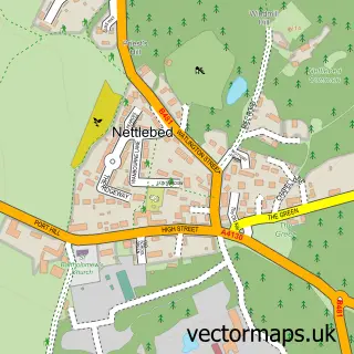
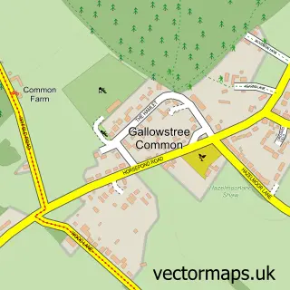
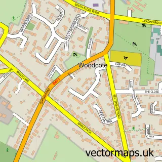
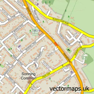
Nearby street map samples around Stoke Row


More street maps in Oxfordshire
750 metre map area coverage
Boundary, postcode and point of interest information for the 750m x 750m rectangle centred on this sample map.
Boundaries containing map centre
Constituency: Henley and Thame Co Const
County: Oxfordshire County
District: South Oxfordshire District
Icb: NHS Thames Valley ICB
Parish: Stoke Row CP
Police Force: thames valley
Postcode District: RG9
Postcode Sector: RG9 5
Ward: Woodcote & Rotherfield Ward
Nearby boundaries intersecting sample
No additional intersecting boundaries found.
Postcode coverage
POI category counts
Clothing Store: 2
Retail: 2
Advertising Agency: 1
Anglican Church: 1
Automotive: 1
Automotive Repair: 1
Bakery: 1
Business Consulting: 1
Charity Organization: 1
Church Cathedral: 1
Sample points of interest
- What's on in Bracknell
- Stoke Row: St. John the Evangelist
- Ebits LLP
- Delta Motor Sport
- Imma The Bakery
- Tozer Consulting
- The Maharajah's Well - Stoke Row, Oxfordshire
- Stoke Row Independent Chapel
- Emporio Made in Italy
- Love Designer Sales
- Rousant Sherwood Manufacturing
- Stoke Row Store
Create a larger editable map of Stoke Row
This sample shows only a 750 metre area. To create a larger map of Stoke Row, use our map builder to choose your own coverage area, add titles and download editable SVG, PDF and PNG files.
Create a custom map of Stoke Row