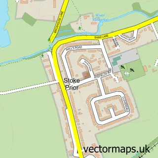
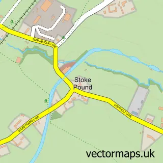
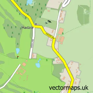
This Stoke Works street map is a detailed vector street map covering a 750m x 750m area. Select a larger area to create and download your own vector street map of Stoke Works.
The 750-metre map sample for Stoke Works covers 80 mapped buildings and approximately 19.4 km of road detail, of which 9 named roads are named. The immediate area includes 2 pubs and 6 MOT stations within 2 miles. The wider area around Stoke Works features 2 food and drink venues. To create a larger or custom map of Stoke Works, the map builder lets you define your own coverage area and download editable SVG, PDF and PNG files.
Create a larger editable map of Stoke Works
Choose any area you need and generate a high-quality vector map instantly. Perfect for print, planning, design, business and personal use.

This Stoke Works street map in Worcestershire is available as downloadable SVG, PDF and PNG map files, or as a printed map for planning, business, display, education, local information and design work. You can also create a larger custom map area using the map selector.
What this Stoke Works map sample shows
Stoke Works lies within Stoke Cp parish, part of Avoncroft ward in the Bromsgrove District local authority area. The postcode geography for this area includes the B postcode area, the B60 postcode district and the B60 4 postcode sector. Residents fall under the Nhs Herefordshire And Worcestershire Integrated Care Board for NHS services.
Local features near Stoke Works
Within 2 milesAmenities and services in and around Stoke Works.
Administrative and postcode information for Stoke Works
Stoke Works lies within Stoke Cp parish, part of Avoncroft ward in the Bromsgrove District local authority area. The postcode geography for this area includes the B postcode area, the B60 postcode district and the B60 4 postcode sector. Residents fall under the Nhs Herefordshire And Worcestershire Integrated Care Board for NHS services.
Nearby street map samples around Stoke Works
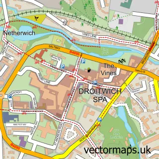

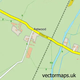
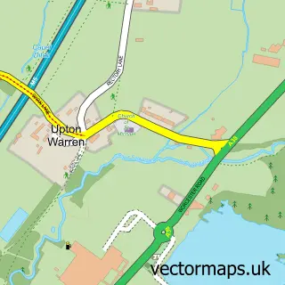
More street maps in Worcestershire
750 metre map area coverage
Boundary, postcode and point of interest information for the 750m x 750m rectangle centred on this sample map.
Boundaries containing map centre
Constituency: Bromsgrove Co Const
County: Worcestershire County
District: Bromsgrove District
Icb: NHS Herefordshire and Worcestershire ICB
Parish: Stoke CP
Police Force: west mercia
Postcode District: B60
Postcode Sector: B60 4
Ward: Avoncroft Ward
Nearby boundaries intersecting sample
Constituency: Redditch Co Const
District: Wychavon District
Parish: Dodderhill CP
Ward: Dodderhill Ward
Postcode coverage
POI category counts
Pub: 2
Building Supply Store: 1
Caterer: 1
Event Planning: 1
Fire Protection Service: 1
Home Improvement Store: 1
Playground: 1
Travel Services: 1
Veterinarian: 1
Sample points of interest
- Kevin Lynskey & Son
- Morgans Catering for You
- Redhouse Barn
- Abex Fire Extinguisher Services
- Skirtech
- Mini Meadows Outdoor Stay & Play
- Boat and Railway
- Bowling Green Inn
- Astwood Top lock
- Meadows Farm Vets Ltd
Create a larger editable map of Stoke Works
This sample shows only a 750 metre area. To create a larger map of Stoke Works, use our map builder to choose your own coverage area, add titles and download editable SVG, PDF and PNG files.
Create a custom map of Stoke Works