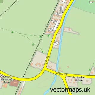
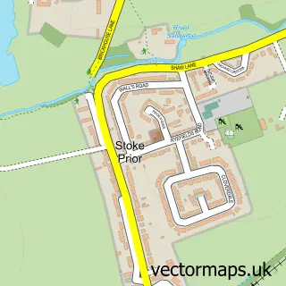
This Wychbold street map is a detailed vector street map covering a 750m x 750m area. Select a larger area to create and download your own vector street map of Wychbold.
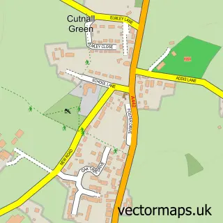
The 750-metre map sample for Wychbold covers 371 mapped buildings and approximately 62.6 km of road detail, of which 29 named roads are named. The immediate area includes 1 school, 4 pubs and 1 MOT station, with 6 within 2 miles. The wider area around Wychbold features 4 food and drink venues and 2 hotels. To create a larger or custom map of Wychbold, the map builder lets you define your own coverage area and download editable SVG, PDF and PNG files.
Create a larger editable map of Wychbold
Choose any area you need and generate a high-quality vector map instantly. Perfect for print, planning, design, business and personal use.

This Wychbold street map in Worcestershire is available as downloadable SVG, PDF and PNG map files, or as a printed map for planning, business, display, education, local information and design work. You can also create a larger custom map area using the map selector.
What this Wychbold map sample shows
Wychbold lies within Dodderhill Cp parish, part of Dodderhill ward in the Wychavon District local authority area. The postcode geography for this area includes the WR postcode area, the WR9 postcode district and the WR9 7 postcode sector. Residents fall under the Nhs Herefordshire And Worcestershire Integrated Care Board for NHS services.
Local features near Wychbold
Within 2 milesAmenities and services in and around Wychbold.
Administrative and postcode information for Wychbold
The local authority covering Wychbold is Wychavon District, within the county of Worcestershire. The settlement lies within Dodderhill ward and Dodderhill Cp civil parish. The WR9 postcode district and WR9 7 postcode sector serve the immediate area. NHS provision in the area is delivered through Worcestershire Acute Hospitals Nhs Trust.
Nearby street map samples around Wychbold

More street maps in Worcestershire
750 metre map area coverage
Boundary, postcode and point of interest information for the 750m x 750m rectangle centred on this sample map.
Boundaries containing map centre
Constituency: Redditch Co Const
County: Worcestershire County
District: Wychavon District
Icb: NHS Herefordshire and Worcestershire ICB
Parish: Dodderhill CP
Police Force: west mercia
Postcode District: WR9
Postcode Sector: WR9 7
Ward: Dodderhill Ward
Nearby boundaries intersecting sample
Postcode Sector: WR9 0
Postcode coverage
POI category counts
Gas Station: 4
Pub: 4
Doctor: 3
Post Office: 3
Building Supply Store: 2
Contractor: 2
Hotel: 2
Indian Restaurant: 2
Social Service Organizations: 2
Venue And Event Space: 2
Sample points of interest
- Wychbold Garage
- GlamLicious nails
- The Beauty Room
- Central Projects & Restoration
- G J Plumbing Services
- Wychbold Fudge
- Tees.kiitchen
- Wychbold Village Hall
- 1st Call Stairways
- Contemporary Driveways
- Londis
- Up Your Alley
Create a larger editable map of Wychbold
This sample shows only a 750 metre area. To create a larger map of Wychbold, use our map builder to choose your own coverage area, add titles and download editable SVG, PDF and PNG files.
Create a custom map of Wychbold