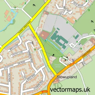
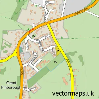
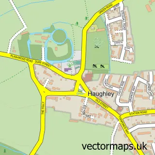
This Stowmarket street map is a detailed vector street map covering a 750m x 750m area. Select a larger area to create and download your own vector street map of Stowmarket.
The 750-metre map sample for Stowmarket covers 314 mapped buildings and approximately 17.4 km of road detail, of which 40 named roads are named. The immediate area includes 1 railway station, 2 GP surgeries within 2 miles, 10 pubs and 1 MOT station, with 10 within 2 miles. The wider area around Stowmarket features 6 tourism points of interest and 28 food and drink venues. To create a larger or custom map of Stowmarket, the map builder lets you define your own coverage area and download editable SVG, PDF and PNG files.
Create a larger editable map of Stowmarket
Choose any area you need and generate a high-quality vector map instantly. Perfect for print, planning, design, business and personal use.

This Stowmarket street map in Suffolk is available as downloadable SVG, PDF and PNG map files, or as a printed map for planning, business, display, education, local information and design work. You can also create a larger custom map area using the map selector.
What this Stowmarket map sample shows
Stowmarket lies within Stowmarket Cp parish, part of St Peter's ward in the Mid Suffolk District local authority area. The postcode geography for this area includes the IP postcode area, the IP14 postcode district and the IP14 1 postcode sector. Residents fall under the Nhs Suffolk And North East Essex Integrated Care Board for NHS services.
Local features near Stowmarket
Within 2 milesAmenities and services in and around Stowmarket.
Administrative and postcode information for Stowmarket
The local authority covering Stowmarket is Mid Suffolk District, within the county of Suffolk. The settlement lies within St Peter's ward and Stowmarket Cp civil parish. The IP14 postcode district and IP14 1 postcode sector serve the immediate area. NHS provision in the area is delivered through East Suffolk And North Essex Nhs Foundation Trust.
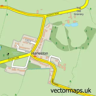
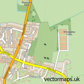
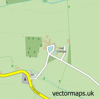
Nearby street map samples around Stowmarket

More street maps in Suffolk
750 metre map area coverage
Boundary, postcode and point of interest information for the 750m x 750m rectangle centred on this sample map.
Boundaries containing map centre
Constituency: Bury St. Edmunds and Stowmarket Co Const
County: Suffolk County
District: Mid Suffolk District
Icb: NHS Essex ICB
Parish: Stowmarket CP
Police Force: suffolk
Postcode District: IP14
Postcode Sector: IP14 1
Ward: St. Peter's Ward
Nearby boundaries intersecting sample
Postcode Sector: IP14 5
Ward: Combs Ford Ward, Stow Thorney Ward
Postcode coverage
POI category counts
Beauty Salon: 12
Pub: 10
Real Estate Agent: 9
Coffee Shop: 8
Professional Services: 8
Barber: 7
Church Cathedral: 7
Home Health Care: 7
Restaurant: 7
Clothing Store: 6
Sample points of interest
- Andrew Prentice Partnership
- TaxAssist Accountants
- Felixstowe Seaside
- BRIX Brand and Creative
- Stowmarket, St Peter & St Mary
- Sewing Machine Centre
- Fox Yard Studio
- Stow Framing
- Wool St
- Oak at Stowmarket
- The Maltings
- Platform 8 Takeaway
Create a larger editable map of Stowmarket
This sample shows only a 750 metre area. To create a larger map of Stowmarket, use our map builder to choose your own coverage area, add titles and download editable SVG, PDF and PNG files.
Create a custom map of Stowmarket