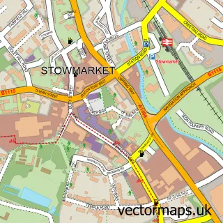
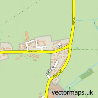
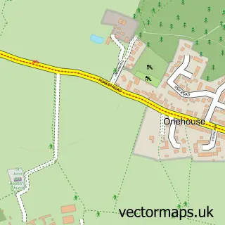
This Stowupland street map is a detailed vector street map covering a 750m x 750m area. Select a larger area to create and download your own vector street map of Stowupland.
The 750-metre map sample for Stowupland covers 348 mapped buildings and approximately 16.5 km of road detail, of which 20 named roads are named. The immediate area includes 1 school, 2 GP surgeries within 2 miles, 2 pubs and 11 MOT stations within 2 miles. The wider area around Stowupland features 3 food and drink venues. To create a larger or custom map of Stowupland, the map builder lets you define your own coverage area and download editable SVG, PDF and PNG files.
Create a larger editable map of Stowupland
Choose any area you need and generate a high-quality vector map instantly. Perfect for print, planning, design, business and personal use.

This Stowupland street map in Suffolk is available as downloadable SVG, PDF and PNG map files, or as a printed map for planning, business, display, education, local information and design work. You can also create a larger custom map area using the map selector.
What this Stowupland map sample shows
Stowupland lies within Stowupland Cp parish, part of Haughley, Stowupland & Wetherden ward in the Mid Suffolk District local authority area. The postcode geography for this area includes the IP postcode area, the IP14 postcode district and the IP14 4 postcode sector. Residents fall under the Nhs Suffolk And North East Essex Integrated Care Board for NHS services.
Local features near Stowupland
Within 2 milesAmenities and services in and around Stowupland.
Administrative and postcode information for Stowupland
Stowupland lies within Stowupland Cp parish, part of Haughley, Stowupland & Wetherden ward in the Mid Suffolk District local authority area. The postcode geography for this area includes the IP postcode area, the IP14 postcode district and the IP14 4 postcode sector. Residents fall under the Nhs Suffolk And North East Essex Integrated Care Board for NHS services.
Nearby street map samples around Stowupland

More street maps in Suffolk
750 metre map area coverage
Boundary, postcode and point of interest information for the 750m x 750m rectangle centred on this sample map.
Boundaries containing map centre
Constituency: Waveney Valley Co Const
County: Suffolk County
District: Mid Suffolk District
Icb: NHS Essex ICB
Parish: Stowupland CP
Police Force: suffolk
Postcode District: IP14
Postcode Sector: IP14 4
Ward: Haughley, Stowupland & Wetherden Ward
Nearby boundaries intersecting sample
No additional intersecting boundaries found.
Postcode coverage
POI category counts
Gas Station: 3
Convenience Store: 2
Martial Arts Club: 2
Pub: 2
Sports And Recreation Venue: 2
Accountant: 1
Assisted Living Facility: 1
Beauty Salon: 1
Building Supply Store: 1
Coffee Shop: 1
Sample points of interest
- Stepping Stones Bookkeeping & Accountancy Services
- Orwell Housing Association
- Chloe's Corner
- J C Carpentry
- Costa Express
- Stowupland Garage & Co-Op
- The Co-Operative
- Stowupland Fish & Chip Shop
- Creeting lakes - Quiet Sports Fisheries
- Lunar Rose Crafts (Online Gift Shop)
- Central Co-op Food & Petrol - Stowupland
- Co-op Food
Create a larger editable map of Stowupland
This sample shows only a 750 metre area. To create a larger map of Stowupland, use our map builder to choose your own coverage area, add titles and download editable SVG, PDF and PNG files.
Create a custom map of Stowupland