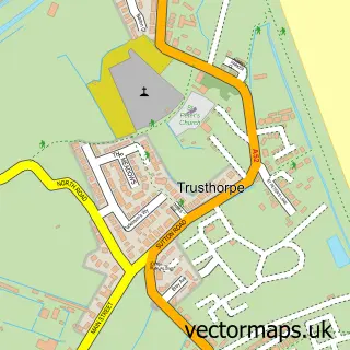
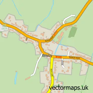
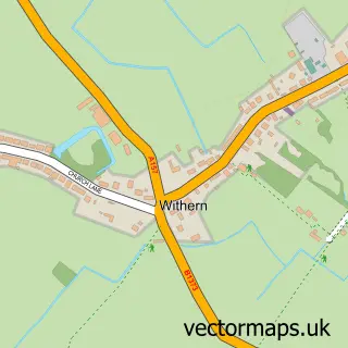
This Sutton-on-Sea street map is a detailed vector street map covering a 750m x 750m area. Select a larger area to create and download your own vector street map of Sutton-on-Sea.
The 750-metre map sample for Sutton-on-Sea covers 480 mapped buildings and approximately 16.5 km of road detail, of which 34 named roads are named. The immediate area includes 1 GP surgery within 2 miles, 3 pubs and 1 MOT station, with 4 within 2 miles. The wider area around Sutton-on-Sea features 1 tourism point of interest, 10 food and drink venues and 2 hotels. To create a larger or custom map of Sutton-on-Sea, the map builder lets you define your own coverage area and download editable SVG, PDF and PNG files.
Create a larger editable map of Sutton-on-Sea
Choose any area you need and generate a high-quality vector map instantly. Perfect for print, planning, design, business and personal use.

This Sutton-on-Sea street map in Lincolnshire is available as downloadable SVG, PDF and PNG map files, or as a printed map for planning, business, display, education, local information and design work. You can also create a larger custom map area using the map selector.
What this Sutton-on-Sea map sample shows
Sutton-on-Sea lies within Mablethorpe And Sutton Cp parish, part of Sutton On Sea ward in the East Lindsey District local authority area. The postcode geography for this area includes the LN postcode area, the LN12 postcode district and the LN12 2 postcode sector. Residents fall under the Nhs Lincolnshire Integrated Care Board for NHS services.
Local features near Sutton-on-Sea
Within 2 milesAmenities and services in and around Sutton-on-Sea.
Administrative and postcode information for Sutton-on-Sea
The local authority covering Sutton-on-Sea is East Lindsey District, within the county of Lincolnshire. The settlement lies within Sutton On Sea ward and Mablethorpe And Sutton Cp civil parish. The LN12 postcode district and LN12 2 postcode sector serve the immediate area. NHS provision in the area is delivered through United Lincolnshire Hospitals Nhs Trust.
Nearby street map samples around Sutton-on-Sea

More street maps in Lincolnshire
750 metre map area coverage
Boundary, postcode and point of interest information for the 750m x 750m rectangle centred on this sample map.
Boundaries containing map centre
Constituency: Louth and Horncastle Co Const
County: Lincolnshire County
District: East Lindsey District
Icb: NHS Lincolnshire ICB
Parish: Mablethorpe and Sutton CP
Police Force: lincolnshire
Postcode District: LN12
Postcode Sector: LN12 2
Ward: Sutton on Sea Ward
Nearby boundaries intersecting sample
Ward: Mablethorpe Ward
Postcode coverage
POI category counts
Retirement Home: 5
Coffee Shop: 4
Funeral Services And Cemeteries: 4
Holiday Rental Home: 4
Hair Salon: 3
Pub: 3
Real Estate Agent: 3
Assisted Living Facility: 2
Bar: 2
Beach: 2
Sample points of interest
- Sutton Rovers FC
- Knicksknacks antiques emporium
- Anchor - Marisco Court
- Anchor Hanover - Reverend Bill Baker Court
- BR Spar Sutton On Sea, Sutton On Sea
- Steve Wood Motors Ltd
- Littledays
- Yorkshire Building Society
- Omega Drinks Ltd.
- The Crow's Nest
- On The Sea Front Sutton-on-sea
- Sutton-on-Sea Beach
Create a larger editable map of Sutton-on-Sea
This sample shows only a 750 metre area. To create a larger map of Sutton-on-Sea, use our map builder to choose your own coverage area, add titles and download editable SVG, PDF and PNG files.
Create a custom map of Sutton-on-Sea