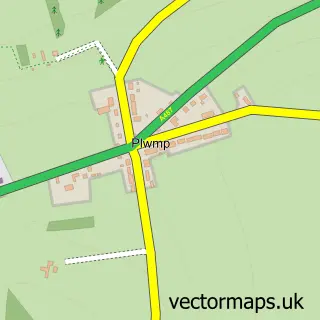
This Synod Inn / Post Mawr street map is a detailed vector street map covering a 750m x 750m area. Select a larger area to create and download your own vector street map of Synod Inn / Post Mawr.
The 750-metre map sample for Synod Inn / Post Mawr covers 42 mapped buildings and approximately 9.3 km of road detail. The wider area around Synod Inn / Post Mawr features 1 hotel and 2 campsites within 2 miles. To create a larger or custom map of Synod Inn / Post Mawr, the map builder lets you define your own coverage area and download editable SVG, PDF and PNG files.
Create a larger editable map of Synod Inn / Post Mawr
Choose any area you need and generate a high-quality vector map instantly. Perfect for print, planning, design, business and personal use.

This Synod Inn / Post Mawr street map in Dyfed is available as downloadable SVG, PDF and PNG map files, or as a printed map for planning, business, display, education, local information and design work. You can also create a larger custom map area using the map selector.
What this Synod Inn / Post Mawr map sample shows
Synod Inn / Post Mawr lies within Llanarth Community parish, part of Llanarth ward in the Sir Ceredigion - Ceredigion local authority area. The postcode geography for this area includes the SA postcode area, the SA44 postcode district and the SA44 6 postcode sector. Residents fall under the Hywel Dda University Health Board for NHS services.
Local features near Synod Inn / Post Mawr
Within 2 milesAmenities and services in and around Synod Inn / Post Mawr.
Administrative and postcode information for Synod Inn / Post Mawr
The local authority covering Synod Inn / Post Mawr is Sir Ceredigion - Ceredigion, within the county of Dyfed. The settlement lies within Llanarth ward and Llanarth Community civil parish. The SA44 postcode district and SA44 6 postcode sector serve the immediate area. NHS provision in the area is delivered through Hywel Dda University Health Board.
Nearby street map samples around Synod Inn / Post Mawr


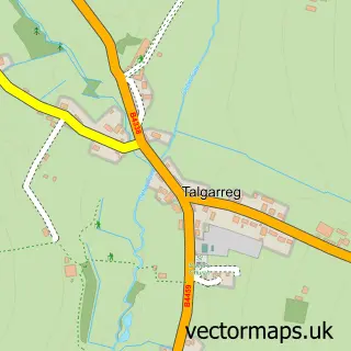
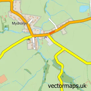
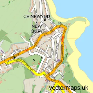
More street maps in Dyfed
750 metre map area coverage
Boundary, postcode and point of interest information for the 750m x 750m rectangle centred on this sample map.
Boundaries containing map centre
Constituency: Ceredigion Preseli Co Const
District: Sir Ceredigion - Ceredigion
Icb: Hywel Dda
Parish: Llanarth Community
Police Force: dyfed-powys
Postcode District: SA44
Postcode Sector: SA44 6
Nearby boundaries intersecting sample
Postcode District: SA47
Postcode Sector: SA47 0
Postcode coverage
POI category counts
Gas Station: 2
Automobile Leasing: 1
Automotive Repair: 1
Bakery: 1
Car Dealer: 1
Holiday Rental Home: 1
Hotel: 1
Travel Services: 1
Sample points of interest
- Car Leasing Bargains
- AMJ Garage Services
- Popty Kates Bakery
- Car Sales Point
- Garej Synod Garage
- Murco
- Synod Ffarm - Holiday Lets Pets Welcome Hot Tub - Ceredigion
- Synod Inn
- Pete's Cabs
Create a larger editable map of Synod Inn / Post Mawr
This sample shows only a 750 metre area. To create a larger map of Synod Inn / Post Mawr, use our map builder to choose your own coverage area, add titles and download editable SVG, PDF and PNG files.
Create a custom map of Synod Inn / Post Mawr