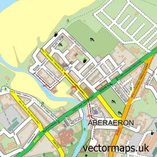
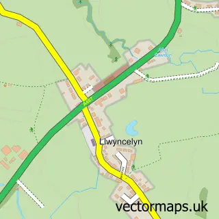
This New Quay street map is a detailed vector street map covering a 750m x 750m area. Select a larger area to create and download your own vector street map of New Quay.
The 750-metre map sample for New Quay covers 192 mapped buildings and approximately 11.4 km of road detail, of which 39 named roads are named. The immediate area includes 1 school and 5 pubs. The wider area around New Quay features 4 tourism points of interest, 13 food and drink venues and 8 hotels. To create a larger or custom map of New Quay, the map builder lets you define your own coverage area and download editable SVG, PDF and PNG files.
Create a larger editable map of New Quay
Choose any area you need and generate a high-quality vector map instantly. Perfect for print, planning, design, business and personal use.

This New Quay street map in Dyfed is available as downloadable SVG, PDF and PNG map files, or as a printed map for planning, business, display, education, local information and design work. You can also create a larger custom map area using the map selector.
What this New Quay map sample shows
New Quay lies within New Quay Community parish, part of New Quay ward in the Sir Ceredigion - Ceredigion local authority area. The postcode geography for this area includes the SA postcode area, the SA45 postcode district and the SA45 9 postcode sector. Local NHS services are provided through Hywel Dda University Health Board.
Local features near New Quay
Within 2 milesAmenities and services in and around New Quay.
Administrative and postcode information for New Quay
New Quay lies within New Quay Community parish, part of New Quay ward in the Sir Ceredigion - Ceredigion local authority area. The postcode geography for this area includes the SA postcode area, the SA45 postcode district and the SA45 9 postcode sector. Local NHS services are provided through Hywel Dda University Health Board.
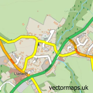
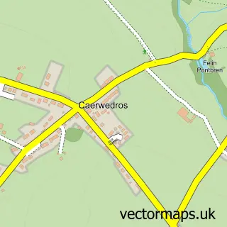
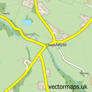
Nearby street map samples around New Quay


More street maps in Dyfed
750 metre map area coverage
Boundary, postcode and point of interest information for the 750m x 750m rectangle centred on this sample map.
Boundaries containing map centre
Constituency: Ceredigion Preseli Co Const
District: Sir Ceredigion - Ceredigion
Icb: Hywel Dda
Parish: New Quay Community
Police Force: dyfed-powys
Postcode District: SA45
Postcode Sector: SA45 9
Nearby boundaries intersecting sample
Parish: Llanllwchaiarn Community
Postcode coverage
POI category counts
Holiday Rental Home: 11
Hotel: 8
Flowers And Gifts Shop: 6
Pub: 5
Beach: 4
Cafe: 4
Community Services Non Profits: 4
Campground: 3
Event Planning: 3
Fish And Chips Restaurant: 3
Sample points of interest
- Newquay Boxing Academy
- NatWest
- NatWest Mobile Branch
- Cei Newydd
- Dolau Beach
- New Quay Beach
- Whipsiderry Beach
- Sue's Style
- Dolau House B and B
- Dolawel B&B
- Dolphin Spotting Boat trips
- Dolphin Survey Boat Trips
Create a larger editable map of New Quay
This sample shows only a 750 metre area. To create a larger map of New Quay, use our map builder to choose your own coverage area, add titles and download editable SVG, PDF and PNG files.
Create a custom map of New Quay