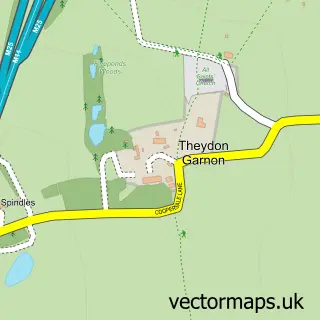
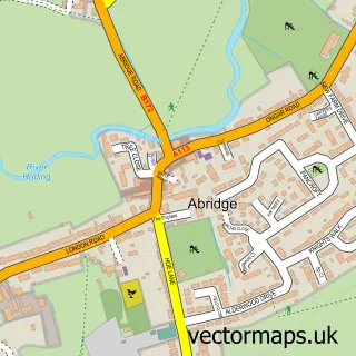
This Theydon Bois street map is a detailed vector street map covering a 750m x 750m area. Select a larger area to create and download your own vector street map of Theydon Bois.
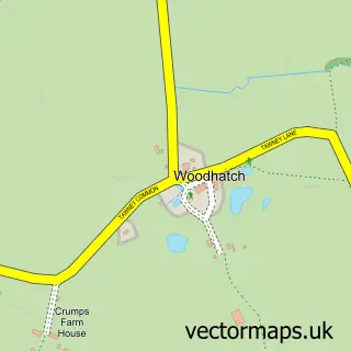
The 750-metre map sample for Theydon Bois covers 351 mapped buildings and approximately 13.8 km of road detail, of which 22 named roads are named. The immediate area includes 1 school, 1 railway station, 2 GP surgeries within 2 miles and 3 pubs among other local services. The wider area around Theydon Bois features 1 tourism point of interest and 9 food and drink venues. To create a larger or custom map of Theydon Bois, the map builder lets you define your own coverage area and download editable SVG, PDF and PNG files.
Create a larger editable map of Theydon Bois
Choose any area you need and generate a high-quality vector map instantly. Perfect for print, planning, design, business and personal use.

This Theydon Bois street map in Essex is available as downloadable SVG, PDF and PNG map files, or as a printed map for planning, business, display, education, local information and design work. You can also create a larger custom map area using the map selector.
What this Theydon Bois map sample shows
Theydon Bois lies within Theydon Bois Cp parish, part of Theydon Bois ward in the Epping Forest District local authority area. The postcode geography for this area includes the CM postcode area, the CM16 postcode district and the CM16 7 postcode sector. Residents fall under the Nhs Hertfordshire And West Essex Integrated Care Board for NHS services.
Local features near Theydon Bois
Within 2 milesAmenities and services in and around Theydon Bois.
Administrative and postcode information for Theydon Bois
Theydon Bois lies within Theydon Bois Cp parish, part of Theydon Bois ward in the Epping Forest District local authority area. The postcode geography for this area includes the CM postcode area, the CM16 postcode district and the CM16 7 postcode sector. Residents fall under the Nhs Hertfordshire And West Essex Integrated Care Board for NHS services.
Nearby street map samples around Theydon Bois

More street maps in Essex
750 metre map area coverage
Boundary, postcode and point of interest information for the 750m x 750m rectangle centred on this sample map.
Boundaries containing map centre
Constituency: Epping Forest Co Const
County: Essex County
District: Epping Forest District
Icb: NHS Central East ICB
Parish: Theydon Bois CP
Police Force: essex
Postcode District: CM16
Postcode Sector: CM16 7
Ward: Theydon Bois with Passingford Ward
Nearby boundaries intersecting sample
No additional intersecting boundaries found.
Postcode coverage
POI category counts
Beauty Salon: 5
Restaurant: 4
Building Supply Store: 3
Physical Therapy: 3
Pub: 3
Beauty And Spa: 2
Business Management Services: 2
Butcher Shop: 2
Italian Restaurant: 2
Jewelry Store: 2
Sample points of interest
- The Alexander Technique Practice
- Prosmart
- Brick Lane Bagel Co.
- Theydon Bois Bakery
- Theydon Beauty
- Treatments by Tash
- Lauren Louise hair salon
- Nigel James Hair Design
- Revival
- Satin Aesthetics
- Small and Cute
- Julia G Addison Wedding Singer
Create a larger editable map of Theydon Bois
This sample shows only a 750 metre area. To create a larger map of Theydon Bois, use our map builder to choose your own coverage area, add titles and download editable SVG, PDF and PNG files.
Create a custom map of Theydon Bois