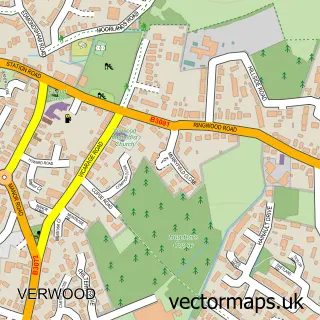
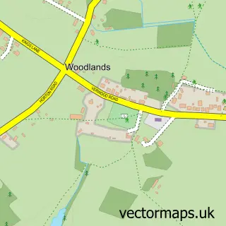
This Three Legged Cross street map is a detailed vector street map covering a 750m x 750m area. Select a larger area to create and download your own vector street map of Three Legged Cross.
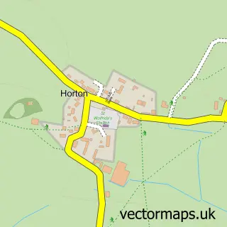
The 750-metre map sample for Three Legged Cross covers 325 mapped buildings and approximately 12.3 km of road detail, of which 19 named roads are named. The immediate area includes 1 school, 1 GP surgery within 2 miles and 1 MOT station, with 10 within 2 miles. The wider area around Three Legged Cross features 2 food and drink venues and 3 campsites within 2 miles. To create a larger or custom map of Three Legged Cross, the map builder lets you define your own coverage area and download editable SVG, PDF and PNG files.
Create a larger editable map of Three Legged Cross
Choose any area you need and generate a high-quality vector map instantly. Perfect for print, planning, design, business and personal use.

This Three Legged Cross street map in Dorset is available as downloadable SVG, PDF and PNG map files, or as a printed map for planning, business, display, education, local information and design work. You can also create a larger custom map area using the map selector.
What this Three Legged Cross map sample shows
Three Legged Cross lies within Verwood Cp parish, part of West Moors & Three Legged Cross ward in the Dorset local authority area. The postcode geography for this area includes the BH postcode area, the BH21 postcode district and the BH21 6 postcode sector. Residents fall under the Nhs Dorset Integrated Care Board for NHS services.
Local features near Three Legged Cross
Within 2 milesAmenities and services in and around Three Legged Cross.
Administrative and postcode information for Three Legged Cross
The local authority covering Three Legged Cross is Dorset, within the county of Dorset. The settlement lies within West Moors & Three Legged Cross ward and Verwood Cp civil parish. The BH21 postcode district and BH21 6 postcode sector serve the immediate area. NHS provision in the area is delivered through University Hospitals Dorset Nhs Foundation Trust.
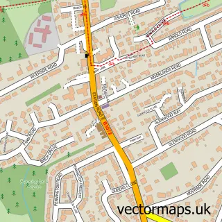
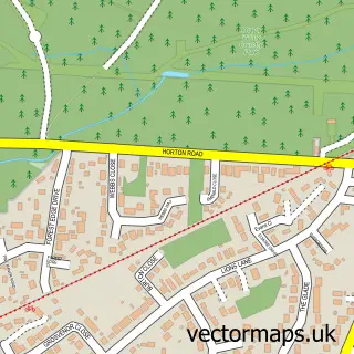
Nearby street map samples around Three Legged Cross

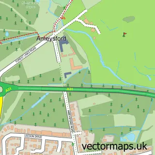
More street maps in Dorset
750 metre map area coverage
Boundary, postcode and point of interest information for the 750m x 750m rectangle centred on this sample map.
Boundaries containing map centre
Constituency: Christchurch Co Const
District: Dorset
Icb: NHS Dorset ICB
Parish: Verwood CP
Police Force: dorset
Postcode District: BH21
Postcode Sector: BH21 6
Ward: West Moors & Three Legged Cross Ward
Nearby boundaries intersecting sample
Constituency: Mid Dorset and North Poole Co Const
Parish: Holt CP, Horton CP
Postcode Sector: BH21 7
Ward: Stour & Allen Vale Ward
Postcode coverage
POI category counts
Convenience Store: 4
Arts And Crafts: 2
Auto Detailing: 2
Building Supply Store: 2
Car Dealer: 2
Elementary School: 2
Furniture Store: 2
Garbage Collection Service: 2
Gym: 2
Retirement Home: 2
Sample points of interest
- Clear Cut Accounts
- Three Legged Cross: All Saints
- Quest Clearance & Services Ltd.
- Vision Aquatics
- Coleshill Accessories
- Craft Obsessions
- Juicy Auctions
- Scratch Heroes Ltd
- Ceramic Pro Dorset
- Gleampro Valeting and Detailing
- Love a Cake
- Bourenmouth Beach
Create a larger editable map of Three Legged Cross
This sample shows only a 750 metre area. To create a larger map of Three Legged Cross, use our map builder to choose your own coverage area, add titles and download editable SVG, PDF and PNG files.
Create a custom map of Three Legged Cross