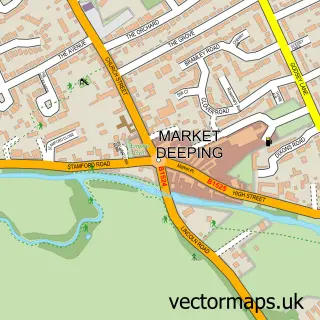
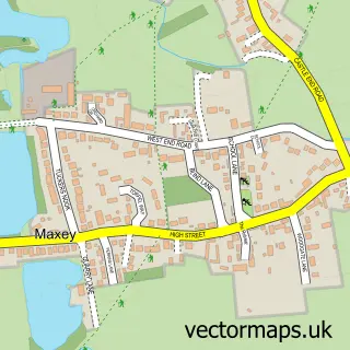
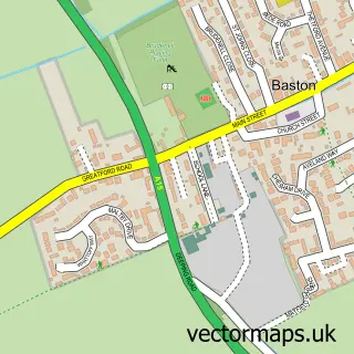
This Towngate street map is a detailed vector street map covering a 750m x 750m area. Select a larger area to create and download your own vector street map of Towngate.
The 750-metre map sample for Towngate covers 436 mapped buildings and approximately 16.7 km of road detail, of which 30 named roads are named. The immediate area includes 1 GP surgery within 2 miles and 6 MOT stations within 2 miles. The wider area around Towngate features 1 food and drink venue. To create a larger or custom map of Towngate, the map builder lets you define your own coverage area and download editable SVG, PDF and PNG files.
Create a larger editable map of Towngate
Choose any area you need and generate a high-quality vector map instantly. Perfect for print, planning, design, business and personal use.

This Towngate street map in Lincolnshire is available as downloadable SVG, PDF and PNG map files, or as a printed map for planning, business, display, education, local information and design work. You can also create a larger custom map area using the map selector.
What this Towngate map sample shows
Towngate lies within Market Deeping Cp parish, part of Market & West Deeping ward in the South Kesteven District local authority area. The postcode geography for this area includes the PE postcode area, the PE6 postcode district and the PE6 8 postcode sector. Residents fall under the Nhs Lincolnshire Integrated Care Board for NHS services.
Local features near Towngate
Within 2 milesAmenities and services in and around Towngate.
Administrative and postcode information for Towngate
Towngate lies within Market Deeping Cp parish, part of Market & West Deeping ward in the South Kesteven District local authority area. The postcode geography for this area includes the PE postcode area, the PE6 postcode district and the PE6 8 postcode sector. Residents fall under the Nhs Lincolnshire Integrated Care Board for NHS services.
Nearby street map samples around Towngate

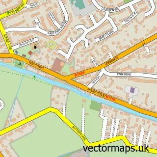
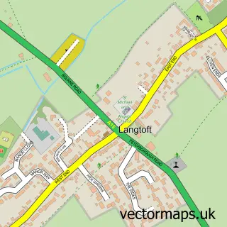
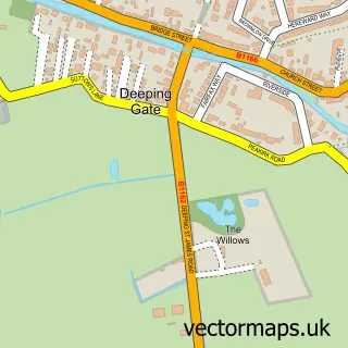
More street maps in Lincolnshire
750 metre map area coverage
Boundary, postcode and point of interest information for the 750m x 750m rectangle centred on this sample map.
Boundaries containing map centre
Constituency: South Holland and The Deepings Co Const
County: Lincolnshire County
District: South Kesteven District
Icb: NHS Lincolnshire ICB
Parish: Market Deeping CP
Police Force: lincolnshire
Postcode District: PE6
Postcode Sector: PE6 8
Ward: Market & West Deeping Ward
Nearby boundaries intersecting sample
No additional intersecting boundaries found.
Postcode coverage
POI category counts
Assisted Living Facility: 1
Bakery: 1
Beauty And Spa: 1
Beauty Salon: 1
Bed And Breakfast: 1
Car Wash: 1
Clothing Store: 1
Community Center: 1
Contractor: 1
Disability Services And Support Organization: 1
Sample points of interest
- Towngate Care Home
- BindersBakes
- Keya Hair Design
- Ruffles Hair & Beauty
- Halfleet Grove
- Fresh Car
- Ruffles of Market Deeping
- Coronation Hall
- Kestrel Group
- 20 Towngate East Voyage Care
- JLB Electrical Ltd
- CityGate Chambers
Create a larger editable map of Towngate
This sample shows only a 750 metre area. To create a larger map of Towngate, use our map builder to choose your own coverage area, add titles and download editable SVG, PDF and PNG files.
Create a custom map of Towngate