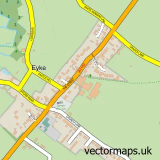
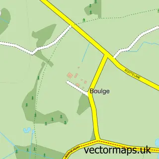
This Ufford street map is a detailed vector street map covering a 750m x 750m area. Select a larger area to create and download your own vector street map of Ufford.
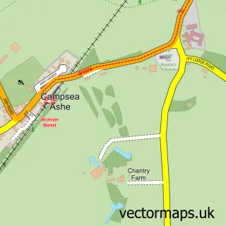
The 750-metre map sample for Ufford covers 187 mapped buildings and approximately 11.9 km of road detail, of which 8 named roads are named. The immediate area includes 1 GP surgery within 2 miles, 1 pub and 1 MOT station within 2 miles. The wider area around Ufford features 1 food and drink venue, 1 hotel and 1 campsite within 2 miles. To create a larger or custom map of Ufford, the map builder lets you define your own coverage area and download editable SVG, PDF and PNG files.
Create a larger editable map of Ufford
Choose any area you need and generate a high-quality vector map instantly. Perfect for print, planning, design, business and personal use.

This Ufford street map in Suffolk is available as downloadable SVG, PDF and PNG map files, or as a printed map for planning, business, display, education, local information and design work. You can also create a larger custom map area using the map selector.
What this Ufford map sample shows
Ufford lies within Ufford Cp parish, part of Wickham Market ward in the East Suffolk District local authority area. The postcode geography for this area includes the IP postcode area, the IP13 postcode district and the IP13 6 postcode sector. Residents fall under the Nhs Suffolk And North East Essex Integrated Care Board for NHS services.
Local features near Ufford
Within 2 milesAmenities and services in and around Ufford.
Administrative and postcode information for Ufford
The local authority covering Ufford is East Suffolk District, within the county of Suffolk. The settlement lies within Wickham Market ward and Ufford Cp civil parish. The IP13 postcode district and IP13 6 postcode sector serve the immediate area. NHS provision in the area is delivered through East Suffolk And North Essex Nhs Foundation Trust.
Nearby street map samples around Ufford

More street maps in Suffolk
750 metre map area coverage
Boundary, postcode and point of interest information for the 750m x 750m rectangle centred on this sample map.
Boundaries containing map centre
Constituency: Central Suffolk and North Ipswich Co Const
County: Suffolk County
District: East Suffolk District
Icb: NHS Essex ICB
Parish: Ufford CP
Police Force: suffolk
Postcode District: IP13
Postcode Sector: IP13 6
Ward: Wickham Market Ward
Nearby boundaries intersecting sample
Parish: Pettistree CP
Postcode Sector: IP13 0
Postcode coverage
POI category counts
Paintball: 3
Alternative Medicine: 1
B2b Textiles: 1
Barber: 1
Fair: 1
Hair Salon: 1
Holiday Rental Home: 1
Hotel: 1
Industrial Equipment: 1
Pub: 1
Sample points of interest
- Kinesiology
- Red House Textiles
- AB Barber
- Bedlam Paintball Ipswich
- Ultra Rapid Edge Scissor Sharpening
- The Corner House Suffolk
- Hope Cottage in Ufford
- SBS Spares
- Go Ballistic
- Nationwide Paintball
- Ukpaintball
- The Ufford Crown
Create a larger editable map of Ufford
This sample shows only a 750 metre area. To create a larger map of Ufford, use our map builder to choose your own coverage area, add titles and download editable SVG, PDF and PNG files.
Create a custom map of Ufford