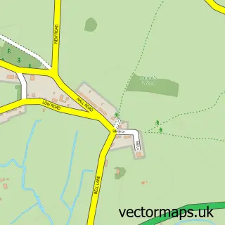
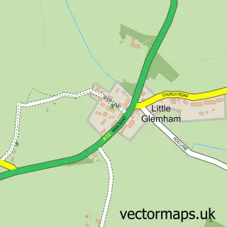
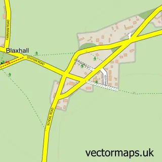
This Campsea Ashe street map is a detailed vector street map covering a 750m x 750m area. Select a larger area to create and download your own vector street map of Campsea Ashe.
The 750-metre map sample for Campsea Ashe covers 51 mapped buildings and approximately 9.2 km of road detail, of which 5 named roads are named. The immediate area includes 1 railway station, 1 GP surgery within 2 miles, 2 pubs and 3 MOT stations within 2 miles. The wider area around Campsea Ashe features 2 food and drink venues and 1 campsite within 2 miles. To create a larger or custom map of Campsea Ashe, the map builder lets you define your own coverage area and download editable SVG, PDF and PNG files.
Create a larger editable map of Campsea Ashe
Choose any area you need and generate a high-quality vector map instantly. Perfect for print, planning, design, business and personal use.

This Campsea Ashe street map in Suffolk is available as downloadable SVG, PDF and PNG map files, or as a printed map for planning, business, display, education, local information and design work. You can also create a larger custom map area using the map selector.
What this Campsea Ashe map sample shows
Campsea Ashe lies within Campsey Ash Cp parish, part of Wickham Market ward in the East Suffolk District local authority area. The postcode geography for this area includes the IP postcode area, the IP13 postcode district and the IP13 0 postcode sector. Residents fall under the Nhs Suffolk And North East Essex Integrated Care Board for NHS services.
Local features near Campsea Ashe
Within 2 milesAmenities and services in and around Campsea Ashe.
Administrative and postcode information for Campsea Ashe
The local authority covering Campsea Ashe is East Suffolk District, within the county of Suffolk. The settlement lies within Wickham Market ward and Campsey Ash Cp civil parish. The IP13 postcode district and IP13 0 postcode sector serve the immediate area. NHS provision in the area is delivered through East Suffolk And North Essex Nhs Foundation Trust.
Nearby street map samples around Campsea Ashe
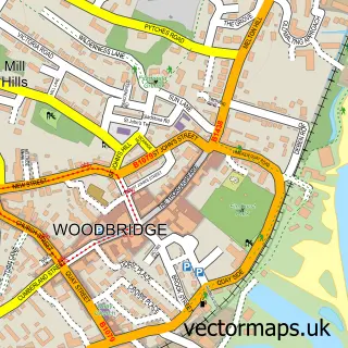

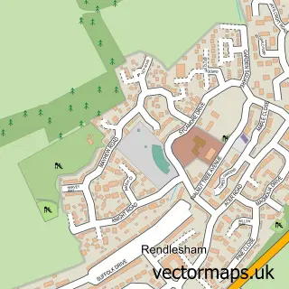
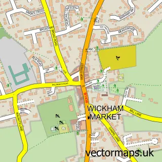
More street maps in Suffolk
750 metre map area coverage
Boundary, postcode and point of interest information for the 750m x 750m rectangle centred on this sample map.
Boundaries containing map centre
Constituency: Central Suffolk and North Ipswich Co Const
County: Suffolk County
District: East Suffolk District
Icb: NHS Essex ICB
Parish: Campsey Ash CP
Police Force: suffolk
Postcode District: IP13
Postcode Sector: IP13 0
Ward: Wickham Market Ward
Nearby boundaries intersecting sample
No additional intersecting boundaries found.
Postcode coverage
POI category counts
Pub: 2
Anglican Church: 1
Auction House: 1
Bed And Breakfast: 1
Community Center: 1
Dance School: 1
Farm: 1
Grocery Store: 1
Holiday Rental Home: 1
Landscaping: 1
Sample points of interest
- Campsea Ashe: St John the Baptist
- Clark And simpson Auction
- The Old Rectory
- Station House Community Connections
- Vikki-Anne School of Performing Arts
- Allonsfield Farm
- Deben Poll Dorsets
- Church Farm Barn
- Tennyson Landscapes
- Dog&Duck
- The Duck
- Allonsfield House Luxury Care Home
Create a larger editable map of Campsea Ashe
This sample shows only a 750 metre area. To create a larger map of Campsea Ashe, use our map builder to choose your own coverage area, add titles and download editable SVG, PDF and PNG files.
Create a custom map of Campsea Ashe