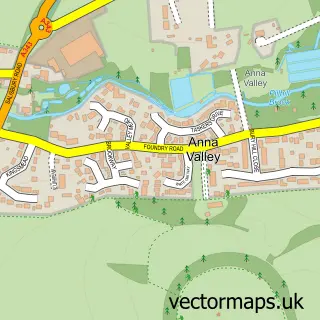
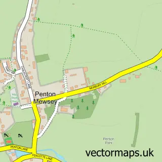
This Upper Clatford street map is a detailed vector street map covering a 750m x 750m area. Select a larger area to create and download your own vector street map of Upper Clatford.
The 750-metre map sample for Upper Clatford covers 183 mapped buildings and approximately 12.2 km of road detail, of which 10 named roads are named. The immediate area includes 4 GP surgeries within 2 miles, 1 pub and 16 MOT stations within 2 miles. The wider area around Upper Clatford features 1 tourism point of interest and 1 food and drink venue. To create a larger or custom map of Upper Clatford, the map builder lets you define your own coverage area and download editable SVG, PDF and PNG files.
Create a larger editable map of Upper Clatford
Choose any area you need and generate a high-quality vector map instantly. Perfect for print, planning, design, business and personal use.

This Upper Clatford street map in Hampshire is available as downloadable SVG, PDF and PNG map files, or as a printed map for planning, business, display, education, local information and design work. You can also create a larger custom map area using the map selector.
What this Upper Clatford map sample shows
Upper Clatford lies within Upper Clatford Cp parish, part of Anna ward in the Test Valley District local authority area. The postcode geography for this area includes the SP postcode area, the SP11 postcode district and the SP11 7 postcode sector. Residents fall under the Nhs Hampshire And Isle Of Wight Integrated Care Board for NHS services.
Local features near Upper Clatford
Within 2 milesAmenities and services in and around Upper Clatford.
Administrative and postcode information for Upper Clatford
The local authority covering Upper Clatford is Test Valley District, within the county of Hampshire. The settlement lies within Anna ward and Upper Clatford Cp civil parish. The SP11 postcode district and SP11 7 postcode sector serve the immediate area. NHS provision in the area is delivered through Hampshire Hospitals Nhs Foundation Trust.
Nearby street map samples around Upper Clatford


More street maps in Hampshire
750 metre map area coverage
Boundary, postcode and point of interest information for the 750m x 750m rectangle centred on this sample map.
Boundaries containing map centre
Constituency: Romsey and Southampton North Co Const
County: Hampshire County
District: Test Valley District
Icb: NHS Hampshire and Isle of Wight ICB
Parish: Upper Clatford CP
Police Force: hampshire
Postcode District: SP11
Postcode Sector: SP11 7
Ward: Anna Ward
Nearby boundaries intersecting sample
Postcode District: SP10
Postcode Sector: SP10 2
Postcode coverage
POI category counts
Church Cathedral: 2
Accountant: 1
Blood And Plasma Donation Center: 1
Cinema: 1
Cleaning Services: 1
Dog Walkers: 1
Dry Cleaning: 1
Education: 1
Farm: 1
Financial Advising: 1
Sample points of interest
- Croombs Chartered Accountants
- Phlebotomy Services
- All Saints Church
- All Saints Church
- King Edward VII Memorial Hall
- C.D.E. Cleaning Services
- Moores Paws Andover
- 5b Cleaning
- Safe Systems
- Hill View Farm Beef
- Malcolm Edwards Wealth Management
- Pascal and Pascal Cleaning Solutions
Create a larger editable map of Upper Clatford
This sample shows only a 750 metre area. To create a larger map of Upper Clatford, use our map builder to choose your own coverage area, add titles and download editable SVG, PDF and PNG files.
Create a custom map of Upper Clatford