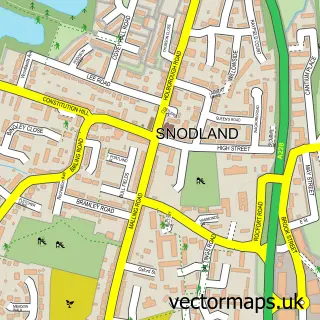
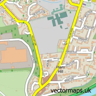
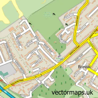
This Upper Halling street map is a detailed vector street map covering a 750m x 750m area. Select a larger area to create and download your own vector street map of Upper Halling.
The 750-metre map sample for Upper Halling covers 106 mapped buildings and approximately 11.7 km of road detail, of which 12 named roads are named. The immediate area includes 2 GP surgeries within 2 miles and 2 MOT stations within 2 miles. The wider area around Upper Halling features 2 tourism points of interest. To create a larger or custom map of Upper Halling, the map builder lets you define your own coverage area and download editable SVG, PDF and PNG files.
Create a larger editable map of Upper Halling
Choose any area you need and generate a high-quality vector map instantly. Perfect for print, planning, design, business and personal use.

This Upper Halling street map in Kent is available as downloadable SVG, PDF and PNG map files, or as a printed map for planning, business, display, education, local information and design work. You can also create a larger custom map area using the map selector.
What this Upper Halling map sample shows
Upper Halling lies within Halling Cp parish, part of Cuxton And Halling ward in the Medway (B) local authority area. The postcode geography for this area includes the ME postcode area, the ME2 postcode district and the ME2 1 postcode sector. Residents fall under the Nhs Kent And Medway Integrated Care Board for NHS services.
Local features near Upper Halling
Within 2 milesAmenities and services in and around Upper Halling.
Administrative and postcode information for Upper Halling
Upper Halling lies within Halling Cp parish, part of Cuxton And Halling ward in the Medway (B) local authority area. The postcode geography for this area includes the ME postcode area, the ME2 postcode district and the ME2 1 postcode sector. Residents fall under the Nhs Kent And Medway Integrated Care Board for NHS services.
Nearby street map samples around Upper Halling

More street maps in Kent
750 metre map area coverage
Boundary, postcode and point of interest information for the 750m x 750m rectangle centred on this sample map.
Boundaries containing map centre
Constituency: Rochester and Strood Co Const
District: Medway (B)
Icb: NHS Kent and Medway ICB
Parish: Halling CP
Police Force: kent
Postcode District: ME2
Postcode Sector: ME2 1
Ward: Cuxton, Halling & Riverside Ward
Nearby boundaries intersecting sample
No additional intersecting boundaries found.
Postcode coverage
POI category counts
Building Supply Store: 2
Butcher Shop: 2
Bakery: 1
Brewery: 1
Community Center: 1
Engineering Services: 1
Landmark And Historical Building: 1
Park: 1
Personal Care Service: 1
Private Tutor: 1
Sample points of interest
- The Cuxton Bakehouse
- Moot Brew Co
- Mcl (Kent) Ltd
- Mobile Plant Machinery Repairs
- Court Farm Butchery & Country Larder
- Court Farm Butchery & Country Larder
- Jubilee Hall
- Industrial Competency Training
- Upper Halling
- Upper Halling Recreation Ground
- Happy Petz
- Paro Tuition
Create a larger editable map of Upper Halling
This sample shows only a 750 metre area. To create a larger map of Upper Halling, use our map builder to choose your own coverage area, add titles and download editable SVG, PDF and PNG files.
Create a custom map of Upper Halling