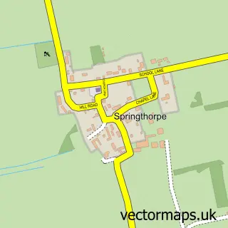
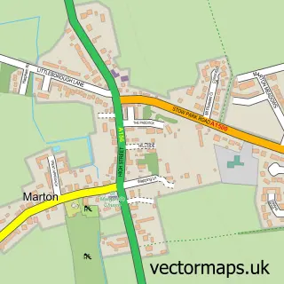
This Upton street map is a detailed vector street map covering a 750m x 750m area. Select a larger area to create and download your own vector street map of Upton.
The 750-metre map sample for Upton covers 226 mapped buildings and approximately 14.0 km of road detail, of which 14 named roads are named. The immediate area includes 1 GP surgery within 2 miles and 2 pubs. The wider area around Upton features 2 food and drink venues and 1 hotel. To create a larger or custom map of Upton, the map builder lets you define your own coverage area and download editable SVG, PDF and PNG files.
Create a larger editable map of Upton
Choose any area you need and generate a high-quality vector map instantly. Perfect for print, planning, design, business and personal use.

This Upton street map in Lincolnshire is available as downloadable SVG, PDF and PNG map files, or as a printed map for planning, business, display, education, local information and design work. You can also create a larger custom map area using the map selector.
What this Upton map sample shows
Upton lies within Upton Cp parish, part of Lea ward in the West Lindsey District local authority area. The postcode geography for this area includes the DN postcode area, the DN21 postcode district and the DN21 5 postcode sector. Residents fall under the Nhs Lincolnshire Integrated Care Board for NHS services.
Local features near Upton
Within 2 milesAmenities and services in and around Upton.
Administrative and postcode information for Upton
The local authority covering Upton is West Lindsey District, within the county of Lincolnshire. The settlement lies within Lea ward and Upton Cp civil parish. The DN21 postcode district and DN21 5 postcode sector serve the immediate area. NHS provision in the area is delivered through United Lincolnshire Hospitals Nhs Trust.
Nearby street map samples around Upton

More street maps in Lincolnshire
750 metre map area coverage
Boundary, postcode and point of interest information for the 750m x 750m rectangle centred on this sample map.
Boundaries containing map centre
Constituency: Gainsborough Co Const
County: Lincolnshire County
District: West Lindsey District
Icb: NHS Lincolnshire ICB
Parish: Upton CP
Police Force: lincolnshire
Postcode District: DN21
Postcode Sector: DN21 5
Ward: Lea Ward
Nearby boundaries intersecting sample
No additional intersecting boundaries found.
Postcode coverage
POI category counts
Pub: 2
Agricultural Service: 1
Anglican Church: 1
Convenience Store: 1
Fish And Chips Restaurant: 1
Home Cleaning: 1
Horseback Riding Service: 1
Hotel: 1
Pest Control Service: 1
Pet Store: 1
Sample points of interest
- Neville Barnes Ltd
- All Saints
- Upton Village Shop
- Upton Fish & Chip Shop
- SAK Industrial Cleaning
- Course & Distance Ltd.
- The Red Lion Inn - Redbourne
- Pestx Ltd
- Paw Prints Dog Training
- Upton Post Office
- Neville Barnes
- Rose And Crown
Create a larger editable map of Upton
This sample shows only a 750 metre area. To create a larger map of Upton, use our map builder to choose your own coverage area, add titles and download editable SVG, PDF and PNG files.
Create a custom map of Upton