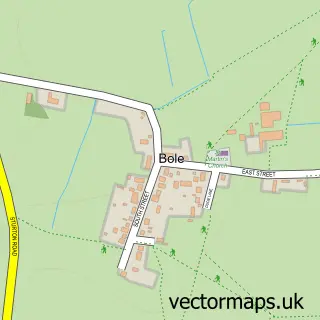
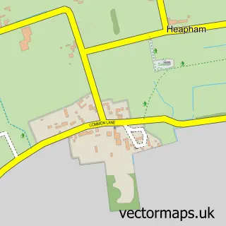
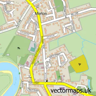
This Lea street map is a detailed vector street map covering a 750m x 750m area. Select a larger area to create and download your own vector street map of Lea.
The 750-metre map sample for Lea covers 349 mapped buildings and approximately 19.0 km of road detail, of which 17 named roads are named. The immediate area includes 1 school and 8 MOT stations within 2 miles. The wider area around Lea features 1 tourism point of interest. To create a larger or custom map of Lea, the map builder lets you define your own coverage area and download editable SVG, PDF and PNG files.
Create a larger editable map of Lea
Choose any area you need and generate a high-quality vector map instantly. Perfect for print, planning, design, business and personal use.

This Lea street map in Lincolnshire is available as downloadable SVG, PDF and PNG map files, or as a printed map for planning, business, display, education, local information and design work. You can also create a larger custom map area using the map selector.
What this Lea map sample shows
Lea lies within Lea Cp parish, part of Lea ward in the West Lindsey District local authority area. The postcode geography for this area includes the DN postcode area, the DN21 postcode district and the DN21 5 postcode sector. Residents fall under the Nhs Lincolnshire Integrated Care Board for NHS services.
Local features near Lea
Within 2 milesAmenities and services in and around Lea.
Administrative and postcode information for Lea
The local authority covering Lea is West Lindsey District, within the county of Lincolnshire. The settlement lies within Lea ward and Lea Cp civil parish. The DN21 postcode district and DN21 5 postcode sector serve the immediate area. NHS provision in the area is delivered through United Lincolnshire Hospitals Nhs Trust.
Nearby street map samples around Lea

More street maps in Lincolnshire
750 metre map area coverage
Boundary, postcode and point of interest information for the 750m x 750m rectangle centred on this sample map.
Boundaries containing map centre
Constituency: Gainsborough Co Const
County: Lincolnshire County
District: West Lindsey District
Icb: NHS Lincolnshire ICB
Parish: Lea CP
Police Force: lincolnshire
Postcode District: DN21
Postcode Sector: DN21 5
Ward: Lea Ward
Nearby boundaries intersecting sample
No additional intersecting boundaries found.
Postcode coverage
POI category counts
Accommodation: 1
Anglican Church: 1
Building Contractor: 1
Building Supply Store: 1
Church Cathedral: 1
Community Center: 1
Contractor: 1
Cupcake Shop: 1
Elementary School: 1
Financial Advising: 1
Sample points of interest
- Redcote Residential home
- St Helen
- S Waplington Cleaning Services
- DS Heating & Plumbing
- St. Helens Church, Lea
- Lea Village Hall
- Raw Tiling and Bathrooms
- Prince of Cupcakes
- Frances Olive Anderson Church of England Primary School
- The Darron Childs Practice
- Paul Francis Design
- Francis Olive Anderson Lea School
Create a larger editable map of Lea
This sample shows only a 750 metre area. To create a larger map of Lea, use our map builder to choose your own coverage area, add titles and download editable SVG, PDF and PNG files.
Create a custom map of Lea