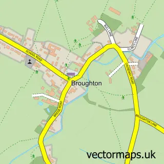
This Warboys street map is a detailed vector street map covering a 750m x 750m area. Select a larger area to create and download your own vector street map of Warboys.
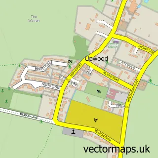
The 750-metre map sample for Warboys covers 556 mapped buildings and approximately 13.7 km of road detail, of which 38 named roads are named. The immediate area includes 1 school, 1 GP surgery, 1 pub and 3 MOT stations within 2 miles. The wider area around Warboys features 2 food and drink venues. To create a larger or custom map of Warboys, the map builder lets you define your own coverage area and download editable SVG, PDF and PNG files.
Create a larger editable map of Warboys
Choose any area you need and generate a high-quality vector map instantly. Perfect for print, planning, design, business and personal use.

This Warboys street map in Cambridgeshire is available as downloadable SVG, PDF and PNG map files, or as a printed map for planning, business, display, education, local information and design work. You can also create a larger custom map area using the map selector.
What this Warboys map sample shows
Warboys lies within Warboys Cp parish, part of Warboys ward in the Huntingdonshire District local authority area. The postcode geography for this area includes the PE postcode area, the PE28 postcode district and the PE28 2 postcode sector. Residents fall under the Nhs Cambridgeshire And Peterborough Integrated Care Board for NHS services.
Local features near Warboys
Within 2 milesAmenities and services in and around Warboys.
Administrative and postcode information for Warboys
Warboys lies within Warboys Cp parish, part of Warboys ward in the Huntingdonshire District local authority area. The postcode geography for this area includes the PE postcode area, the PE28 postcode district and the PE28 2 postcode sector. Residents fall under the Nhs Cambridgeshire And Peterborough Integrated Care Board for NHS services.
Nearby street map samples around Warboys

More street maps in Cambridgeshire
750 metre map area coverage
Boundary, postcode and point of interest information for the 750m x 750m rectangle centred on this sample map.
Boundaries containing map centre
Constituency: Huntingdon Co Const
County: Cambridgeshire County
District: Huntingdonshire District
Icb: NHS Central East ICB
Parish: Warboys CP
Police Force: cambridgeshire
Postcode District: PE28
Postcode Sector: PE28 2
Ward: Warboys Ward
Nearby boundaries intersecting sample
No additional intersecting boundaries found.
Postcode coverage
POI category counts
Contractor: 3
Convenience Store: 2
Hair Salon: 2
Naturopathic Holistic: 2
Amateur Sports Team: 1
Assisted Living Facility: 1
Atms: 1
Bakery: 1
Baptist Church: 1
Beauty Salon: 1
Sample points of interest
- Warboys Town F.C.
- Peverel Management Services
- BR Spar Warboys , Warboys
- Windmill Bakery
- Warboys Baptist Church
- Belle Beauty
- Ben & Co. Construction Ltd.
- W Helme Joinery
- Friends of Warboys Day Centre
- Zarni Baby
- Audrey Sirdar Wools and Poppy Range Knitwear
- 1st Warboys Scout
Create a larger editable map of Warboys
This sample shows only a 750 metre area. To create a larger map of Warboys, use our map builder to choose your own coverage area, add titles and download editable SVG, PDF and PNG files.
Create a custom map of Warboys