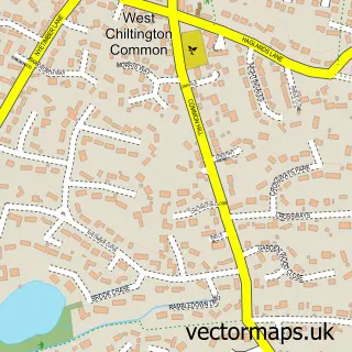
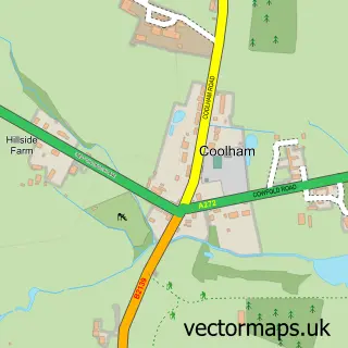
This West Chiltington street map is a detailed vector street map covering a 750m x 750m area. Select a larger area to create and download your own vector street map of West Chiltington.
The 750-metre map sample for West Chiltington covers 252 mapped buildings and approximately 8.9 km of road detail, of which 13 named roads are named. The immediate area includes 1 school, 1 pub and 1 MOT station within 2 miles. The wider area around West Chiltington features 1 food and drink venue. To create a larger or custom map of West Chiltington, the map builder lets you define your own coverage area and download editable SVG, PDF and PNG files.
Create a larger editable map of West Chiltington
Choose any area you need and generate a high-quality vector map instantly. Perfect for print, planning, design, business and personal use.

This West Chiltington street map in West Sussex is available as downloadable SVG, PDF and PNG map files, or as a printed map for planning, business, display, education, local information and design work. You can also create a larger custom map area using the map selector.
What this West Chiltington map sample shows
West Chiltington lies within West Chiltington Cp parish, part of West Chiltington, Thakeham & Ashington ward in the Horsham District local authority area. The postcode geography for this area includes the RH postcode area, the RH20 postcode district and the RH20 2 postcode sector. Residents fall under the Nhs Sussex Integrated Care Board for NHS services.
Local features near West Chiltington
Within 2 milesAmenities and services in and around West Chiltington.
Administrative and postcode information for West Chiltington
The local authority covering West Chiltington is Horsham District, within the county of West Sussex. The settlement lies within West Chiltington, Thakeham & Ashington ward and West Chiltington Cp civil parish. The RH20 postcode district and RH20 2 postcode sector serve the immediate area. NHS provision in the area is delivered through University Hospitals Sussex Nhs Foundation Trust.
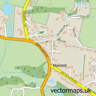
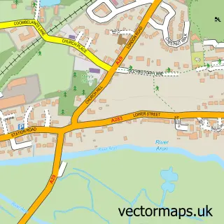
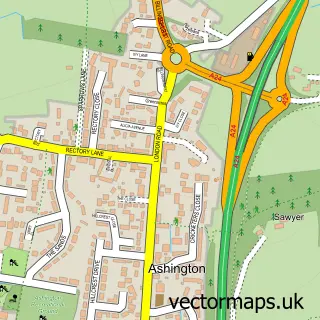
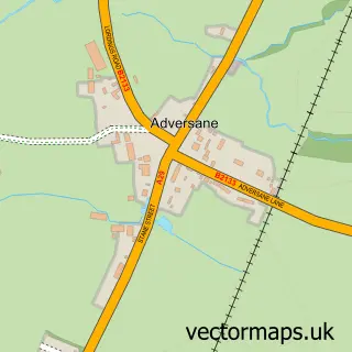
Nearby street map samples around West Chiltington

More street maps in West Sussex
750 metre map area coverage
Boundary, postcode and point of interest information for the 750m x 750m rectangle centred on this sample map.
Boundaries containing map centre
Constituency: Arundel and South Downs Co Const
County: West Sussex County
District: Horsham District
Icb: NHS Surrey and Sussex ICB
Parish: West Chiltington CP
Police Force: sussex
Postcode District: RH20
Postcode Sector: RH20 2
Ward: West Chiltington, Thakeham & Ashington Ward
Nearby boundaries intersecting sample
No additional intersecting boundaries found.
Postcode coverage
POI category counts
Advertising Agency: 1
Church Cathedral: 1
Clothing Store: 1
Elementary School: 1
Flowers And Gifts Shop: 1
Hardware Store: 1
Korean Grocery Store: 1
Music School: 1
Pet Boarding: 1
Printing Equipment And Supply: 1
Sample points of interest
- Pilot Design & Advertising
- St Mary's Church
- Gravenor's
- West Chiltington Community School
- Khandi Home & Gift
- HD Tools
- West Chiltington Post Office
- GJ's Rock School
- Sussex Super Dogs
- Adprint
- Silk Stitch Promotional Textiles
- The Queens Head West Chiltington
Create a larger editable map of West Chiltington
This sample shows only a 750 metre area. To create a larger map of West Chiltington, use our map builder to choose your own coverage area, add titles and download editable SVG, PDF and PNG files.
Create a custom map of West Chiltington