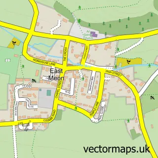
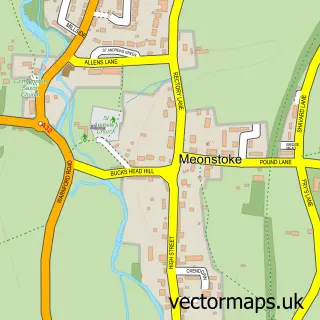
This West Meon street map is a detailed vector street map covering a 750m x 750m area. Select a larger area to create and download your own vector street map of West Meon.
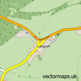
The 750-metre map sample for West Meon covers 182 mapped buildings and approximately 16.9 km of road detail, of which 12 named roads are named. The immediate area includes 1 school, 1 GP surgery and 1 pub. The wider area around West Meon features 1 tourism point of interest, 2 food and drink venues and 3 hotels. To create a larger or custom map of West Meon, the map builder lets you define your own coverage area and download editable SVG, PDF and PNG files.
Create a larger editable map of West Meon
Choose any area you need and generate a high-quality vector map instantly. Perfect for print, planning, design, business and personal use.

This West Meon street map in Hampshire is available as downloadable SVG, PDF and PNG map files, or as a printed map for planning, business, display, education, local information and design work. You can also create a larger custom map area using the map selector.
What this West Meon map sample shows
West Meon lies within West Meon Cp parish, part of Upper Meon Valley ward in the Winchester District (B) local authority area. The postcode geography for this area includes the GU postcode area, the GU32 postcode district and the GU32 1 postcode sector. Residents fall under the Nhs Hampshire And Isle Of Wight Integrated Care Board for NHS services.
Local features near West Meon
Within 2 milesAmenities and services in and around West Meon.
Administrative and postcode information for West Meon
The local authority covering West Meon is Winchester District (B), within the county of Hampshire. The settlement lies within Upper Meon Valley ward and West Meon Cp civil parish. The GU32 postcode district and GU32 1 postcode sector serve the immediate area. NHS provision in the area is delivered through Hampshire Hospitals Nhs Foundation Trust.
Nearby street map samples around West Meon

More street maps in Hampshire
750 metre map area coverage
Boundary, postcode and point of interest information for the 750m x 750m rectangle centred on this sample map.
Boundaries containing map centre
Constituency: Winchester Co Const
County: Hampshire County
District: Winchester District (B)
Icb: NHS Hampshire and Isle of Wight ICB
Parish: West Meon CP
Police Force: hampshire
Postcode District: GU32
Postcode Sector: GU32 1
Ward: Upper Meon Valley Ward
Nearby boundaries intersecting sample
No additional intersecting boundaries found.
Postcode coverage
POI category counts
Hotel: 3
Butcher Shop: 2
Flowers And Gifts Shop: 2
Beverage Supplier: 1
Business Management Services: 1
Church Cathedral: 1
Clothing Store: 1
Coffee Shop: 1
Community Center: 1
Convenience Store: 1
Sample points of interest
- Hamilton Brown Stocktaking
- Anodos Information Systems Strategy Ltd.
- Buckinghams
- Smiths of West Meon
- St John the Evangelist Church
- Allez UK
- Cuppacheeno
- West Meon Village Hall
- West Meon Village Shop
- The Little School - West Meon
- A Young
- West Meon Church of England Primary School
Create a larger editable map of West Meon
This sample shows only a 750 metre area. To create a larger map of West Meon, use our map builder to choose your own coverage area, add titles and download editable SVG, PDF and PNG files.
Create a custom map of West Meon