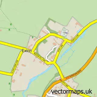
This East Meon street map is a detailed vector street map covering a 750m x 750m area. Select a larger area to create and download your own vector street map of East Meon.
The 750-metre map sample for East Meon covers 214 mapped buildings and approximately 13.8 km of road detail, of which 14 named roads are named. The immediate area includes 1 school and 3 pubs. The wider area around East Meon features 1 tourism point of interest, 3 food and drink venues and 1 hotel. To create a larger or custom map of East Meon, the map builder lets you define your own coverage area and download editable SVG, PDF and PNG files.
Create a larger editable map of East Meon
Choose any area you need and generate a high-quality vector map instantly. Perfect for print, planning, design, business and personal use.

This East Meon street map in Hampshire is available as downloadable SVG, PDF and PNG map files, or as a printed map for planning, business, display, education, local information and design work. You can also create a larger custom map area using the map selector.
What this East Meon map sample shows
East Meon lies within East Meon Cp parish, part of Buriton & East Meon ward in the East Hampshire District local authority area. The postcode geography for this area includes the GU postcode area, the GU32 postcode district and the GU32 1 postcode sector. Residents fall under the Nhs Hampshire And Isle Of Wight Integrated Care Board for NHS services.
Local features near East Meon
Within 2 milesAmenities and services in and around East Meon.
Administrative and postcode information for East Meon
East Meon lies within East Meon Cp parish, part of Buriton & East Meon ward in the East Hampshire District local authority area. The postcode geography for this area includes the GU postcode area, the GU32 postcode district and the GU32 1 postcode sector. Residents fall under the Nhs Hampshire And Isle Of Wight Integrated Care Board for NHS services.
Nearby street map samples around East Meon

More street maps in Hampshire
750 metre map area coverage
Boundary, postcode and point of interest information for the 750m x 750m rectangle centred on this sample map.
Boundaries containing map centre
Constituency: East Hampshire Co Const
County: Hampshire County
District: East Hampshire District
Icb: NHS Hampshire and Isle of Wight ICB
Parish: East Meon CP
Police Force: hampshire
Postcode District: GU32
Postcode Sector: GU32 1
Ward: Buriton & East Meon Ward
Nearby boundaries intersecting sample
No additional intersecting boundaries found.
Postcode coverage
POI category counts
Pub: 3
Church Cathedral: 2
Dentist: 2
Shipping Center: 2
Bed And Breakfast: 1
Campground: 1
Chimney Sweep: 1
Community Center: 1
Convenience Store: 1
Elementary School: 1
Sample points of interest
- Pound Orchard East Meon
- Duncoombe Farm
- Meon Valley Chimney Sweep
- All Saints Church
- All Saints Church East Meon
- East Meon Village Hall
- East Meon Stores
- Iosis Clinic Ltd
- Mydentist Petersfield
- East Meon CE Primary School
- NWVT.co.uk Professional Automotive Photography And Design
- The Blacksmiths Daughter
Create a larger editable map of East Meon
This sample shows only a 750 metre area. To create a larger map of East Meon, use our map builder to choose your own coverage area, add titles and download editable SVG, PDF and PNG files.
Create a custom map of East Meon