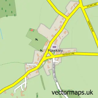
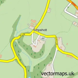
This High Cross street map is a detailed vector street map covering a 750m x 750m area. Select a larger area to create and download your own vector street map of High Cross.
The 750-metre map sample for High Cross covers 61 mapped buildings and approximately 8.3 km of road detail, of which 6 named roads are named. The immediate area includes 1 school and 1 MOT station within 2 miles. To create a larger or custom map of High Cross, the map builder lets you define your own coverage area and download editable SVG, PDF and PNG files.
Create a larger editable map of High Cross
Choose any area you need and generate a high-quality vector map instantly. Perfect for print, planning, design, business and personal use.

This High Cross street map in Hampshire is available as downloadable SVG, PDF and PNG map files, or as a printed map for planning, business, display, education, local information and design work. You can also create a larger custom map area using the map selector.
What this High Cross map sample shows
High Cross lies within Froxfield And Privett Cp parish, part of Froxfield, Sheet & Steep ward in the East Hampshire District local authority area. The postcode geography for this area includes the GU postcode area, the GU32 postcode district and the GU32 1 postcode sector. Residents fall under the Nhs Hampshire And Isle Of Wight Integrated Care Board for NHS services.
Local features near High Cross
Within 2 milesAmenities and services in and around High Cross.
Administrative and postcode information for High Cross
The local authority covering High Cross is East Hampshire District, within the county of Hampshire. The settlement lies within Froxfield, Sheet & Steep ward and Froxfield And Privett Cp civil parish. The GU32 postcode district and GU32 1 postcode sector serve the immediate area. NHS provision in the area is delivered through Portsmouth Hospitals University National Health Service Trust.
Nearby street map samples around High Cross

More street maps in Hampshire
750 metre map area coverage
Boundary, postcode and point of interest information for the 750m x 750m rectangle centred on this sample map.
Boundaries containing map centre
Constituency: East Hampshire Co Const
County: Hampshire County
District: East Hampshire District
Icb: NHS Hampshire and Isle of Wight ICB
Parish: Froxfield and Privett CP
Police Force: hampshire
Postcode District: GU32
Postcode Sector: GU32 1
Ward: Froxfield, Sheet & Steep Ward
Nearby boundaries intersecting sample
No additional intersecting boundaries found.
Postcode coverage
POI category counts
Elementary School: 2
Anglican Church: 1
Business Management Services: 1
Community Center: 1
Currency Exchange: 1
Event Planning: 1
Home Service: 1
Music School: 1
Pet Services: 1
Post Office: 1
Sample points of interest
- High Cross, St Peter
- Post Office-Froxfield
- Froxfield Village Hall
- Post Office Travel Money
- Froxfield Church of England Primary School
- Froxfield Infants School
- The Country Celebrant
- Pure & Simple Window Cleaning
- Sutton's Singing Lessons
- Coleus Kennels
- Froxfield Stores & Post Office
- High Cross, Hampshire
Create a larger editable map of High Cross
This sample shows only a 750 metre area. To create a larger map of High Cross, use our map builder to choose your own coverage area, add titles and download editable SVG, PDF and PNG files.
Create a custom map of High Cross