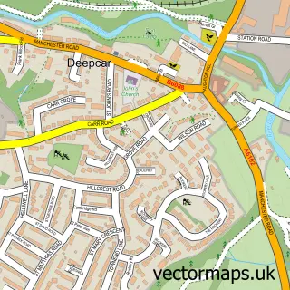
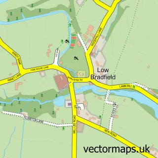
This Wharncliffe Side street map is a detailed vector street map covering a 750m x 750m area. Select a larger area to create and download your own vector street map of Wharncliffe Side.
The 750-metre map sample for Wharncliffe Side covers 219 mapped buildings and approximately 12.7 km of road detail, of which 12 named roads are named. The immediate area includes 1 school, 1 GP surgery within 2 miles, 1 pub and 1 MOT station within 2 miles. The wider area around Wharncliffe Side features 2 food and drink venues. To create a larger or custom map of Wharncliffe Side, the map builder lets you define your own coverage area and download editable SVG, PDF and PNG files.
Create a larger editable map of Wharncliffe Side
Choose any area you need and generate a high-quality vector map instantly. Perfect for print, planning, design, business and personal use.

This Wharncliffe Side street map in South Yorkshire is available as downloadable SVG, PDF and PNG map files, or as a printed map for planning, business, display, education, local information and design work. You can also create a larger custom map area using the map selector.
What this Wharncliffe Side map sample shows
Wharncliffe Side lies within Bradfield Cp parish, part of Stocksbridge And Upper Don ward in the Sheffield District (B) local authority area. The postcode geography for this area includes the S postcode area, the S35 postcode district and the S35 0 postcode sector. Residents fall under the Nhs South Yorkshire Integrated Care Board for NHS services.
Local features near Wharncliffe Side
Within 2 milesAmenities and services in and around Wharncliffe Side.
Administrative and postcode information for Wharncliffe Side
The local authority covering Wharncliffe Side is Sheffield District (B), within the county of South Yorkshire. The settlement lies within Stocksbridge And Upper Don ward and Bradfield Cp civil parish. The S35 postcode district and S35 0 postcode sector serve the immediate area. NHS provision in the area is delivered through Sheffield Teaching Hospitals Nhs Foundation Trust.
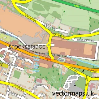
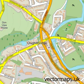
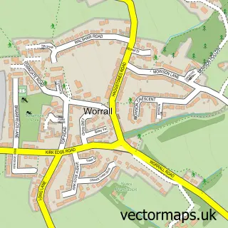
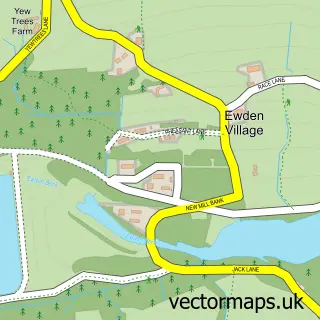
Nearby street map samples around Wharncliffe Side

More street maps in South Yorkshire
750 metre map area coverage
Boundary, postcode and point of interest information for the 750m x 750m rectangle centred on this sample map.
Boundaries containing map centre
Constituency: Penistone and Stocksbridge Co Const
District: Sheffield District (B)
Icb: NHS South Yorkshire ICB
Parish: Bradfield CP
Police Force: south yorkshire
Postcode District: S35
Postcode Sector: S35 0
Ward: Stocksbridge & Upper Don Ward
Nearby boundaries intersecting sample
District: Barnsley District (B)
Parish: Wortley CP
Ward: Penistone East Ward
Postcode coverage
POI category counts
Chinese Restaurant: 2
Korean Grocery Store: 2
Automotive Services And Repair: 1
Bar: 1
Cafe: 1
Carpenter: 1
Child Care And Day Care: 1
Church Cathedral: 1
Community Center: 1
Currency Exchange: 1
Sample points of interest
- MRT
- The Blue Ball
- Brightholmlee Community Café
- Rosewood Loft Creations
- Dragon Friends Out of School Club
- Wharncliffe Side Chinese
- Wharncliffe Side Chinese
- Brightholmlee Methodist Church
- Wharncliffe Side Community Centre
- Post Office Travel Money
- Vildmark Education
- Wharncliffe Side Primary School
Create a larger editable map of Wharncliffe Side
This sample shows only a 750 metre area. To create a larger map of Wharncliffe Side, use our map builder to choose your own coverage area, add titles and download editable SVG, PDF and PNG files.
Create a custom map of Wharncliffe Side