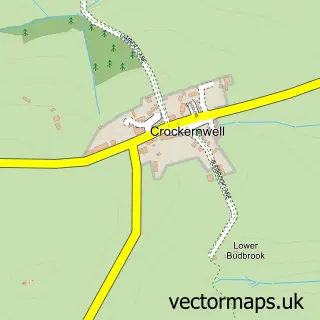
This Whiddon Down street map is a detailed vector street map covering a 750m x 750m area. Select a larger area to create and download your own vector street map of Whiddon Down.
The 750-metre map sample for Whiddon Down covers 58 mapped buildings and approximately 15.2 km of road detail, of which 3 named roads are named. The immediate area includes 2 pubs. The wider area around Whiddon Down features 1 tourism point of interest, 3 food and drink venues and 1 campsite within 2 miles. To create a larger or custom map of Whiddon Down, the map builder lets you define your own coverage area and download editable SVG, PDF and PNG files.
Create a larger editable map of Whiddon Down
Choose any area you need and generate a high-quality vector map instantly. Perfect for print, planning, design, business and personal use.

This Whiddon Down street map in Devon is available as downloadable SVG, PDF and PNG map files, or as a printed map for planning, business, display, education, local information and design work. You can also create a larger custom map area using the map selector.
What this Whiddon Down map sample shows
Whiddon Down lies within Drewsteignton Cp parish, part of Drewsteignton ward in the West Devon District (B) local authority area. The postcode geography for this area includes the EX postcode area, the EX20 postcode district and the EX20 2 postcode sector. Residents fall under the Nhs Devon Integrated Care Board for NHS services.
Local features near Whiddon Down
Within 2 milesAmenities and services in and around Whiddon Down.
Administrative and postcode information for Whiddon Down
The local authority covering Whiddon Down is West Devon District (B), within the county of Devon. The settlement lies within Drewsteignton ward and Drewsteignton Cp civil parish. The EX20 postcode district and EX20 2 postcode sector serve the immediate area. NHS provision in the area is delivered through Royal Devon University Healthcare Nhs Foundation Trust.
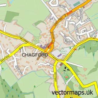
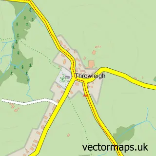
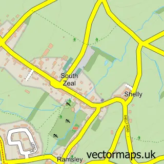
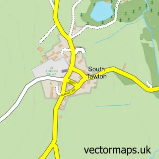
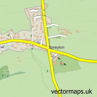
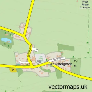
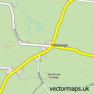
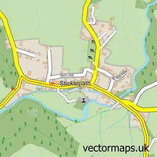
Nearby street map samples around Whiddon Down

More street maps in Devon
750 metre map area coverage
Boundary, postcode and point of interest information for the 750m x 750m rectangle centred on this sample map.
Boundaries containing map centre
Constituency: Central Devon Co Const
County: Devon County
District: West Devon District (B)
Icb: NHS Devon ICB
Parish: Drewsteignton CP
Police Force: devon and cornwall
Postcode District: EX20
Postcode Sector: EX20 2
Ward: Drewsteignton Ward
Nearby boundaries intersecting sample
Parish: South Tawton CP
Postcode District: EX6
Postcode Sector: EX6 6
Ward: South Tawton Ward
Postcode coverage
POI category counts
Gas Station: 5
Package Locker: 2
Pub: 2
Advertising Agency: 1
Agricultural Service: 1
Appliance Repair Service: 1
Bakery: 1
Coffee Shop: 1
Convenience Store: 1
Hvac Supplier: 1
Sample points of interest
- Bill Palmer
- Southwest Handling Ltd
- Dartmoor Domestic Appliance Repairs
- GREGGS
- Costa Coffee
- SPAR
- ESSO RONTEC WHIDDON DOWN
- ESSO Station
- Esso
- Whiddon Down Service Area
- Whiddon Down Services
- Cs Plumbing And Bathrooms
Create a larger editable map of Whiddon Down
This sample shows only a 750 metre area. To create a larger map of Whiddon Down, use our map builder to choose your own coverage area, add titles and download editable SVG, PDF and PNG files.
Create a custom map of Whiddon Down