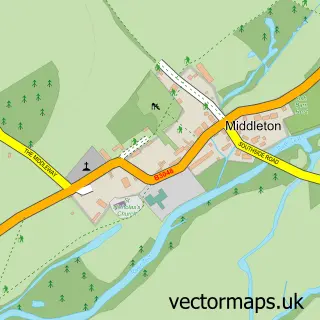
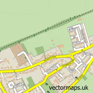
This Whitchurch street map is a detailed vector street map covering a 750m x 750m area. Select a larger area to create and download your own vector street map of Whitchurch.
The 750-metre map sample for Whitchurch covers 425 mapped buildings and approximately 17.1 km of road detail, of which 44 named roads are named. The immediate area includes 1 school, 1 GP surgery, 3 pubs and 1 MOT station, with 2 within 2 miles. The wider area around Whitchurch features 1 tourism point of interest, 5 food and drink venues and 1 hotel. To create a larger or custom map of Whitchurch, the map builder lets you define your own coverage area and download editable SVG, PDF and PNG files.
Create a larger editable map of Whitchurch
Choose any area you need and generate a high-quality vector map instantly. Perfect for print, planning, design, business and personal use.

This Whitchurch street map in Hampshire is available as downloadable SVG, PDF and PNG map files, or as a printed map for planning, business, display, education, local information and design work. You can also create a larger custom map area using the map selector.
What this Whitchurch map sample shows
Whitchurch lies within Whitchurch Cp parish, part of Whitchurch ward in the Basingstoke And Deane District (B) local authority area. The postcode geography for this area includes the RG postcode area, the RG28 postcode district and the RG28 7 postcode sector. Residents fall under the Nhs Hampshire And Isle Of Wight Integrated Care Board for NHS services.
Local features near Whitchurch
Within 2 milesAmenities and services in and around Whitchurch.
Administrative and postcode information for Whitchurch
Whitchurch lies within Whitchurch Cp parish, part of Whitchurch ward in the Basingstoke And Deane District (B) local authority area. The postcode geography for this area includes the RG postcode area, the RG28 postcode district and the RG28 7 postcode sector. Residents fall under the Nhs Hampshire And Isle Of Wight Integrated Care Board for NHS services.
Nearby street map samples around Whitchurch

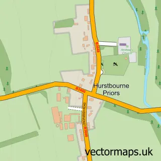
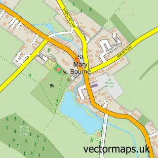
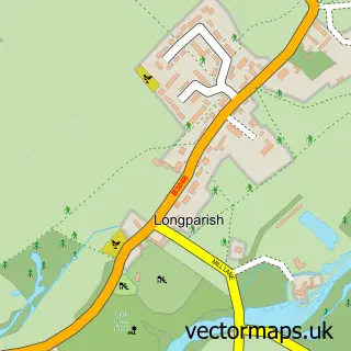
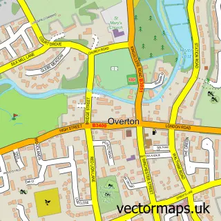
More street maps in Hampshire
750 metre map area coverage
Boundary, postcode and point of interest information for the 750m x 750m rectangle centred on this sample map.
Boundaries containing map centre
Constituency: North West Hampshire Co Const
County: Hampshire County
District: Basingstoke and Deane District (B)
Icb: NHS Hampshire and Isle of Wight ICB
Parish: Whitchurch CP
Police Force: hampshire
Postcode District: RG28
Postcode Sector: RG28 7
Ward: Whitchurch, Overton & Laverstoke Ward
Nearby boundaries intersecting sample
No additional intersecting boundaries found.
Postcode coverage
POI category counts
Flowers And Gifts Shop: 4
Hair Salon: 4
Clothing Store: 3
Convenience Store: 3
Home Goods Store: 3
Professional Services: 3
Pub: 3
Retirement Home: 3
Automotive Repair: 2
Bar: 2
Sample points of interest
- Fuel4vision
- Reflections Hypnotherapy
- All Hallows, Whitchurch
- The Little Chapel Whitchurch
- York Associates
- Blue Rickshaw
- The Cooperative Food (BF) Whitchurch - Bell Street
- Clacys Garage Ltd
- Haytov & Son's Auto Repairs
- The Village Bakery
- Hot Spice
- Newbury Building Society
Create a larger editable map of Whitchurch
This sample shows only a 750 metre area. To create a larger map of Whitchurch, use our map builder to choose your own coverage area, add titles and download editable SVG, PDF and PNG files.
Create a custom map of Whitchurch