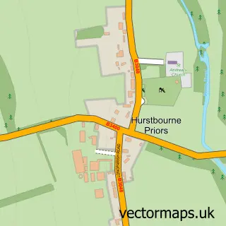
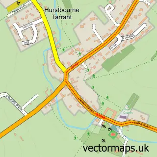
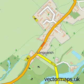
This St Mary Bourne street map is a detailed vector street map covering a 750m x 750m area. Select a larger area to create and download your own vector street map of St Mary Bourne.
The 750-metre map sample for St Mary Bourne covers 181 mapped buildings and approximately 9.9 km of road detail, of which 7 named roads are named. The immediate area includes 2 pubs and 1 MOT station within 2 miles. The wider area around St Mary Bourne features 1 tourism point of interest and 4 food and drink venues. To create a larger or custom map of St Mary Bourne, the map builder lets you define your own coverage area and download editable SVG, PDF and PNG files.
Create a larger editable map of St Mary Bourne
Choose any area you need and generate a high-quality vector map instantly. Perfect for print, planning, design, business and personal use.

This St Mary Bourne street map in Hampshire is available as downloadable SVG, PDF and PNG map files, or as a printed map for planning, business, display, education, local information and design work. You can also create a larger custom map area using the map selector.
What this St Mary Bourne map sample shows
St Mary Bourne lies within St. Mary Bourne Cp parish, part of Burghclere, Highclere And St Mary Bourne ward in the Basingstoke And Deane District (B) local authority area. The postcode geography for this area includes the SP postcode area, the SP11 postcode district and the SP11 6 postcode sector. Residents fall under the Nhs Hampshire And Isle Of Wight Integrated Care Board for NHS services.
Local features near St Mary Bourne
Within 2 milesAmenities and services in and around St Mary Bourne.
Administrative and postcode information for St Mary Bourne
St Mary Bourne lies within St. Mary Bourne Cp parish, part of Burghclere, Highclere And St Mary Bourne ward in the Basingstoke And Deane District (B) local authority area. The postcode geography for this area includes the SP postcode area, the SP11 postcode district and the SP11 6 postcode sector. Residents fall under the Nhs Hampshire And Isle Of Wight Integrated Care Board for NHS services.
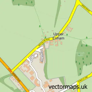
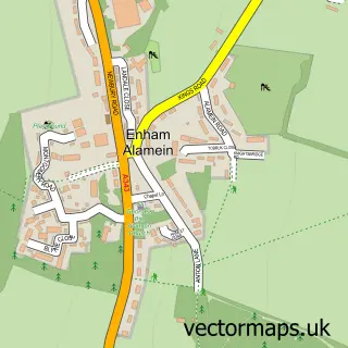
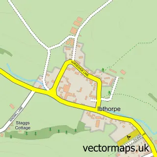
Nearby street map samples around St Mary Bourne

More street maps in Hampshire
750 metre map area coverage
Boundary, postcode and point of interest information for the 750m x 750m rectangle centred on this sample map.
Boundaries containing map centre
Constituency: North West Hampshire Co Const
County: Hampshire County
District: Basingstoke and Deane District (B)
Icb: NHS Hampshire and Isle of Wight ICB
Parish: St. Mary Bourne CP
Police Force: hampshire
Postcode District: SP11
Postcode Sector: SP11 6
Ward: Evingar Ward
Nearby boundaries intersecting sample
No additional intersecting boundaries found.
Postcode coverage
POI category counts
Convenience Store: 2
Pub: 2
Public Service And Government: 2
Sports Club And League: 2
Anglican Church: 1
Boxing Class: 1
Cafe: 1
Cemeteries: 1
Doctor: 1
Education: 1
Sample points of interest
- St Peter, St Mary Bourne
- FIGHT KLUB
- The Boundary
- Breach Farm Woodland Burial Ground
- Londis St Marybourne Shop
- St Mary Bourne Village Shop
- Derry Down Clinic
- Skills Passport
- Zak's Parties and Events
- Audrey Robinson Garden Design
- St Mary Bourne
- The George
Create a larger editable map of St Mary Bourne
This sample shows only a 750 metre area. To create a larger map of St Mary Bourne, use our map builder to choose your own coverage area, add titles and download editable SVG, PDF and PNG files.
Create a custom map of St Mary Bourne