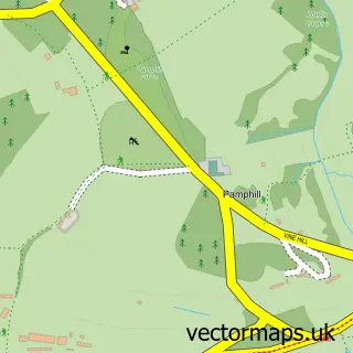
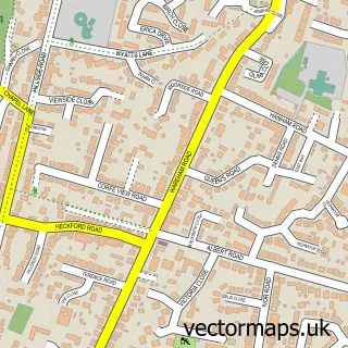
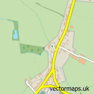
This Wimborne Minster street map is a detailed vector street map covering a 750m x 750m area. Select a larger area to create and download your own vector street map of Wimborne Minster.
The 750-metre map sample for Wimborne Minster covers 313 mapped buildings and approximately 17.1 km of road detail, of which 40 named roads are named. The immediate area includes 1 primary school and 1 secondary school, 1 GP surgery, with 2 within 2 miles, 19 pubs and 5 MOT stations within 2 miles. The wider area around Wimborne Minster features 8 tourism points of interest, 40 food and drink venues and 2 hotels. To create a larger or custom map of Wimborne Minster, the map builder lets you define your own coverage area and download editable SVG, PDF and PNG files.
Create a larger editable map of Wimborne Minster
Choose any area you need and generate a high-quality vector map instantly. Perfect for print, planning, design, business and personal use.

This Wimborne Minster street map in Dorset is available as downloadable SVG, PDF and PNG map files, or as a printed map for planning, business, display, education, local information and design work. You can also create a larger custom map area using the map selector.
What this Wimborne Minster map sample shows
Wimborne Minster lies within Wimborne Minster Cp parish, part of Wimborne Minster ward in the Dorset local authority area. The postcode geography for this area includes the BH postcode area, the BH21 postcode district and the BH21 1 postcode sector. Residents fall under the Nhs Dorset Integrated Care Board for NHS services.
Local features near Wimborne Minster
Within 2 milesAmenities and services in and around Wimborne Minster.
Administrative and postcode information for Wimborne Minster
Wimborne Minster lies within Wimborne Minster Cp parish, part of Wimborne Minster ward in the Dorset local authority area. The postcode geography for this area includes the BH postcode area, the BH21 postcode district and the BH21 1 postcode sector. Residents fall under the Nhs Dorset Integrated Care Board for NHS services.
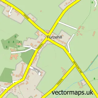
Nearby street map samples around Wimborne Minster

More street maps in Dorset
750 metre map area coverage
Boundary, postcode and point of interest information for the 750m x 750m rectangle centred on this sample map.
Boundaries containing map centre
Constituency: Mid Dorset and North Poole Co Const
District: Dorset
Icb: NHS Dorset ICB
Parish: Wimborne Minster CP
Police Force: dorset
Postcode District: BH21
Postcode Sector: BH21 1
Ward: Wimborne Minster Ward
Nearby boundaries intersecting sample
No additional intersecting boundaries found.
Postcode coverage
POI category counts
Pub: 19
Clothing Store: 15
Hair Salon: 13
Cafe: 11
Professional Services: 11
Beauty Salon: 8
Charity Organization: 8
Real Estate Agent: 8
Flowers And Gifts Shop: 7
Property Management: 7
Sample points of interest
- Atreus Accountants Ltd.
- Clarke & Partners Llp
- England & Company
- Hill Osborne
- Lintern-Mole Leney Accountants
- Thomas & Woolven
- Redcotts Playing Fields
- APC Graphics
- Kyleighs Papercuts
- P I Marketing
- The Around Guides for Dorset
- Vertical Marketing
Create a larger editable map of Wimborne Minster
This sample shows only a 750 metre area. To create a larger map of Wimborne Minster, use our map builder to choose your own coverage area, add titles and download editable SVG, PDF and PNG files.
Create a custom map of Wimborne Minster