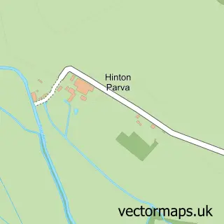
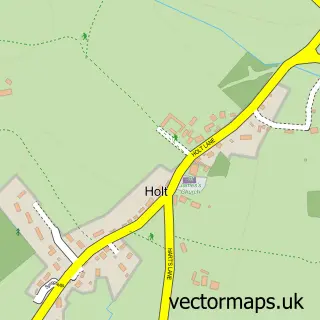
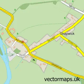
This Pamphill street map is a detailed vector street map covering a 750m x 750m area. Select a larger area to create and download your own vector street map of Pamphill.
The 750-metre map sample for Pamphill covers 34 mapped buildings and approximately 6.3 km of road detail, of which 3 named roads are named. The immediate area includes 1 school, 2 GP surgeries within 2 miles, 1 pub and 2 MOT stations within 2 miles. The wider area around Pamphill features 3 tourism points of interest, 1 food and drink venue and 2 campsites within 2 miles. To create a larger or custom map of Pamphill, the map builder lets you define your own coverage area and download editable SVG, PDF and PNG files.
Create a larger editable map of Pamphill
Choose any area you need and generate a high-quality vector map instantly. Perfect for print, planning, design, business and personal use.

This Pamphill street map in Dorset is available as downloadable SVG, PDF and PNG map files, or as a printed map for planning, business, display, education, local information and design work. You can also create a larger custom map area using the map selector.
What this Pamphill map sample shows
Pamphill lies within Pamphill Cp parish, part of Stour & Allen Vale ward in the Dorset local authority area. The postcode geography for this area includes the BH postcode area, the BH21 postcode district and the BH21 4 postcode sector. Residents fall under the Nhs Dorset Integrated Care Board for NHS services.
Local features near Pamphill
Within 2 milesAmenities and services in and around Pamphill.
Administrative and postcode information for Pamphill
The local authority covering Pamphill is Dorset, within the county of Dorset. The settlement lies within Stour & Allen Vale ward and Pamphill Cp civil parish. The BH21 postcode district and BH21 4 postcode sector serve the immediate area. NHS provision in the area is delivered through University Hospitals Dorset Nhs Foundation Trust.
Nearby street map samples around Pamphill

More street maps in Dorset
750 metre map area coverage
Boundary, postcode and point of interest information for the 750m x 750m rectangle centred on this sample map.
Boundaries containing map centre
Constituency: Mid Dorset and North Poole Co Const
District: Dorset
Icb: NHS Dorset ICB
Parish: Pamphill CP
Police Force: dorset
Postcode District: BH21
Postcode Sector: BH21 4
Ward: Stour & Allen Vale Ward
Nearby boundaries intersecting sample
No additional intersecting boundaries found.
Postcode coverage
POI category counts
Elementary School: 2
Park: 2
Archery Range: 1
Attractions And Activities: 1
Building Supply Store: 1
Day Care Preschool: 1
Pub: 1
Sample points of interest
- Sagittarii
- Bluebell Wood
- KMA Shot Blasting Limited
- Pamphill Pre-School
- Pamphill C of E First School
- Pamphill Church of England First School
- Pamphill Green
- Pamphill Green
- The Vine
Create a larger editable map of Pamphill
This sample shows only a 750 metre area. To create a larger map of Pamphill, use our map builder to choose your own coverage area, add titles and download editable SVG, PDF and PNG files.
Create a custom map of Pamphill