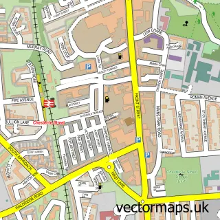
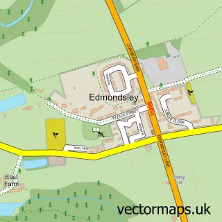
This Witton Gilbert street map is a detailed vector street map covering a 750m x 750m area. Select a larger area to create and download your own vector street map of Witton Gilbert.
The 750-metre map sample for Witton Gilbert covers 289 mapped buildings and approximately 14.9 km of road detail, of which 20 named roads are named. The immediate area includes 1 school, 3 GP surgeries within 2 miles, 4 pubs and 7 MOT stations within 2 miles. The wider area around Witton Gilbert features 4 food and drink venues and 1 hotel. To create a larger or custom map of Witton Gilbert, the map builder lets you define your own coverage area and download editable SVG, PDF and PNG files.
Create a larger editable map of Witton Gilbert
Choose any area you need and generate a high-quality vector map instantly. Perfect for print, planning, design, business and personal use.

This Witton Gilbert street map in Durham is available as downloadable SVG, PDF and PNG map files, or as a printed map for planning, business, display, education, local information and design work. You can also create a larger custom map area using the map selector.
What this Witton Gilbert map sample shows
Witton Gilbert lies within Witton Gilbert Cp parish, part of Esh And Witton Gilbert ward in the County Durham local authority area. The postcode geography for this area includes the DH postcode area, the DH7 postcode district and the DH7 6 postcode sector. Residents fall under the Nhs North East And North Cumbria Integrated Care Board for NHS services.
Local features near Witton Gilbert
Within 2 milesAmenities and services in and around Witton Gilbert.
Administrative and postcode information for Witton Gilbert
Witton Gilbert lies within Witton Gilbert Cp parish, part of Esh And Witton Gilbert ward in the County Durham local authority area. The postcode geography for this area includes the DH postcode area, the DH7 postcode district and the DH7 6 postcode sector. Residents fall under the Nhs North East And North Cumbria Integrated Care Board for NHS services.
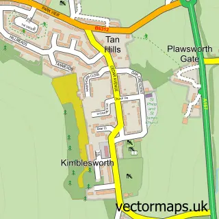
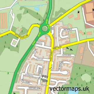
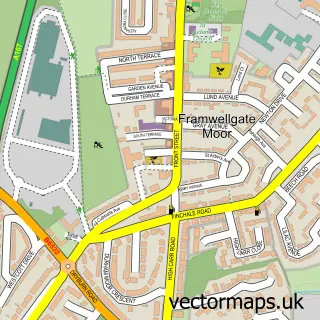
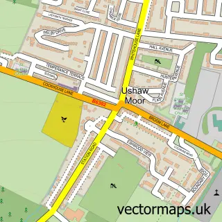
Nearby street map samples around Witton Gilbert

More street maps in Durham
750 metre map area coverage
Boundary, postcode and point of interest information for the 750m x 750m rectangle centred on this sample map.
Boundaries containing map centre
Constituency: City of Durham Co Const
District: County Durham
Icb: NHS North East and North Cumbria ICB
Parish: Witton Gilbert CP
Police Force: durham
Postcode District: DH7
Postcode Sector: DH7 6
Nearby boundaries intersecting sample
No additional intersecting boundaries found.
Postcode coverage
POI category counts
Pub: 4
Elementary School: 2
Atms: 1
Auto Body Shop: 1
Bakery: 1
Beauty Salon: 1
Building Supply Store: 1
Chinese Restaurant: 1
Church Cathedral: 1
Community Center: 1
Sample points of interest
- Morrisons Daily - Witton Gilbert Sacriston, County Durham
- Dent-tek Paintless Dent Removal
- Cake Lady Creations
- Lauren Benwell Semi Permanent Makeup
- North East Planters Gardening Services
- Golden Dragon Wingate
- St Michael & All Angels
- Witton Gilbert Community Centre
- A W Building Services
- Nes Cottage
- Witton Gilbert Nursery
- Sean Maitland School of Motoring
Create a larger editable map of Witton Gilbert
This sample shows only a 750 metre area. To create a larger map of Witton Gilbert, use our map builder to choose your own coverage area, add titles and download editable SVG, PDF and PNG files.
Create a custom map of Witton Gilbert