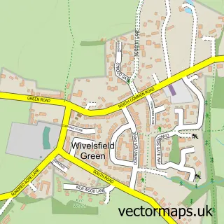
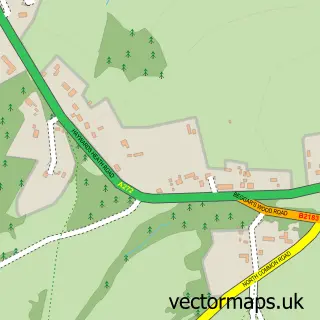
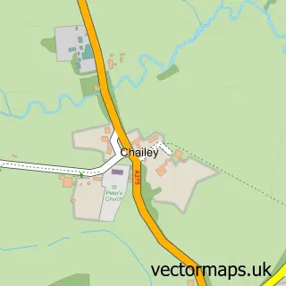
This Wivelsfield street map is a detailed vector street map covering a 750m x 750m area. Select a larger area to create and download your own vector street map of Wivelsfield.
The 750-metre map sample for Wivelsfield covers 135 mapped buildings and approximately 5.9 km of road detail, of which 6 named roads are named. The immediate area includes 1 GP surgery within 2 miles and 1 MOT station, with 5 within 2 miles. To create a larger or custom map of Wivelsfield, the map builder lets you define your own coverage area and download editable SVG, PDF and PNG files.
Create a larger editable map of Wivelsfield
Choose any area you need and generate a high-quality vector map instantly. Perfect for print, planning, design, business and personal use.

This Wivelsfield street map in East Sussex is available as downloadable SVG, PDF and PNG map files, or as a printed map for planning, business, display, education, local information and design work. You can also create a larger custom map area using the map selector.
What this Wivelsfield map sample shows
Wivelsfield lies within Wivelsfield Cp parish, part of Wivelsfield ward in the Lewes District local authority area. The postcode geography for this area includes the RH postcode area, the RH17 postcode district and the RH17 7 postcode sector. Residents fall under the Nhs Sussex Integrated Care Board for NHS services.
Local features near Wivelsfield
Within 2 milesAmenities and services in and around Wivelsfield.
Administrative and postcode information for Wivelsfield
Wivelsfield lies within Wivelsfield Cp parish, part of Wivelsfield ward in the Lewes District local authority area. The postcode geography for this area includes the RH postcode area, the RH17 postcode district and the RH17 7 postcode sector. Residents fall under the Nhs Sussex Integrated Care Board for NHS services.
Nearby street map samples around Wivelsfield
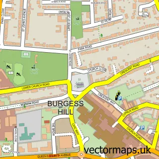

More street maps in East Sussex
750 metre map area coverage
Boundary, postcode and point of interest information for the 750m x 750m rectangle centred on this sample map.
Boundaries containing map centre
Constituency: East Grinstead and Uckfield Co Const
County: East Sussex County
District: Lewes District
Icb: NHS Surrey and Sussex ICB
Parish: Wivelsfield CP
Police Force: sussex
Postcode District: RH17
Postcode Sector: RH17 7
Ward: Wivelsfield Ward
Nearby boundaries intersecting sample
Constituency: Lewes Co Const
Parish: Ditchling CP, Westmeston CP
Postcode District: RH15
Postcode Sector: RH15 0
Ward: Ditchling & Westmeston Ward
Postcode coverage
POI category counts
Car Dealer: 4
Advertising Agency: 1
Automotive: 1
Automotive Repair: 1
Cleaning Services: 1
Community Center: 1
Convenience Store: 1
Dance School: 1
Electrical Wholesaler: 1
Electronic Parts Supplier: 1
Sample points of interest
- Marsh Graphic Design
- Baldocks of Wivelsfield Ltd.
- Motability Scheme at Baldocks Kia of Wivelsfield
- Baldocks Wivelsfield Service Centre
- Barnard and Brough (Haywards Heath)
- Barnard and Brough Nissan
- Nissan_en_GB
- Heathmere
- Wivelsfield Village Hall
- Morrisons Daily- Wivelsfield
- Dance with Emily
- Otehall Switches
Create a larger editable map of Wivelsfield
This sample shows only a 750 metre area. To create a larger map of Wivelsfield, use our map builder to choose your own coverage area, add titles and download editable SVG, PDF and PNG files.
Create a custom map of Wivelsfield