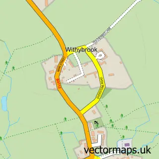
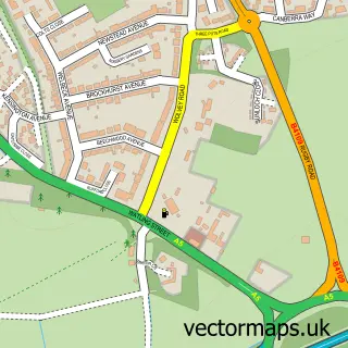
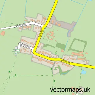
This Wolvey street map is a detailed vector street map covering a 750m x 750m area. Select a larger area to create and download your own vector street map of Wolvey.
The 750-metre map sample for Wolvey covers 266 mapped buildings and approximately 21.8 km of road detail, of which 21 named roads are named. The immediate area includes 2 pubs. The wider area around Wolvey features 3 tourism points of interest, 2 food and drink venues and 1 campsite within 2 miles. To create a larger or custom map of Wolvey, the map builder lets you define your own coverage area and download editable SVG, PDF and PNG files.
Create a larger editable map of Wolvey
Choose any area you need and generate a high-quality vector map instantly. Perfect for print, planning, design, business and personal use.

This Wolvey street map in Warwickshire is available as downloadable SVG, PDF and PNG map files, or as a printed map for planning, business, display, education, local information and design work. You can also create a larger custom map area using the map selector.
What this Wolvey map sample shows
Wolvey lies within Wolvey Cp parish, part of Wolvey And Shilton ward in the Rugby District (B) local authority area. The postcode geography for this area includes the LE postcode area, the LE10 postcode district and the LE10 3 postcode sector. Residents fall under the Nhs Coventry And Warwickshire Integrated Care Board for NHS services.
Local features near Wolvey
Within 2 milesAmenities and services in and around Wolvey.
Administrative and postcode information for Wolvey
Wolvey lies within Wolvey Cp parish, part of Wolvey And Shilton ward in the Rugby District (B) local authority area. The postcode geography for this area includes the LE postcode area, the LE10 postcode district and the LE10 3 postcode sector. Residents fall under the Nhs Coventry And Warwickshire Integrated Care Board for NHS services.
Nearby street map samples around Wolvey

More street maps in Warwickshire
750 metre map area coverage
Boundary, postcode and point of interest information for the 750m x 750m rectangle centred on this sample map.
Boundaries containing map centre
Constituency: Rugby Co Const
County: Warwickshire County
District: Rugby District (B)
Icb: NHS Coventry and Warwickshire ICB
Parish: Wolvey CP
Police Force: warwickshire
Postcode District: LE10
Postcode Sector: LE10 3
Ward: Wolvey and Shilton Ward
Nearby boundaries intersecting sample
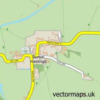
Parish: Burton Hastings CP
Postcode coverage
POI category counts
Sports Club And League: 3
Building Supply Store: 2
Campground: 2
Pub: 2
Amateur Sports Team: 1
Anglican Church: 1
Art Gallery: 1
Audiovisual Equipment Rental: 1
Automotive Repair: 1
Beauty Salon: 1
Sample points of interest
- Bedworth RFC Mini & Junior Section
- Wolvey - St. John Baptist
- Kinkou
- Shirley Skip Hire
- Rhino UK
- Wit Woo Beauty
- Balloon Memories
- David & Matt Jones
- David Jones
- 5 Ways Lakes
- 5 Ways Lakes
- Oak Doors 'n' Floors
Create a larger editable map of Wolvey
This sample shows only a 750 metre area. To create a larger map of Wolvey, use our map builder to choose your own coverage area, add titles and download editable SVG, PDF and PNG files.
Create a custom map of Wolvey