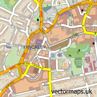
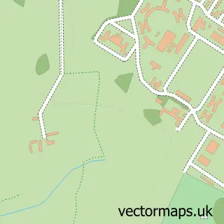
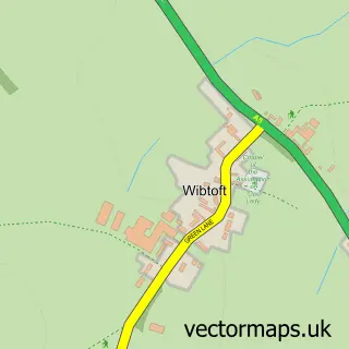
This Stretton Baskerville street map is a detailed vector street map covering a 750m x 750m area. Select a larger area to create and download your own vector street map of Stretton Baskerville.
The 750-metre map sample for Stretton Baskerville covers 253 mapped buildings and approximately 26.3 km of road detail, of which 18 named roads are named. The immediate area includes 5 GP surgeries within 2 miles, 2 pubs and 18 MOT stations within 2 miles. The wider area around Stretton Baskerville features 4 food and drink venues and 2 hotels. To create a larger or custom map of Stretton Baskerville, the map builder lets you define your own coverage area and download editable SVG, PDF and PNG files.
Create a larger editable map of Stretton Baskerville
Choose any area you need and generate a high-quality vector map instantly. Perfect for print, planning, design, business and personal use.

This Stretton Baskerville street map in Leicestershire is available as downloadable SVG, PDF and PNG map files, or as a printed map for planning, business, display, education, local information and design work. You can also create a larger custom map area using the map selector.
What this Stretton Baskerville map sample shows
Stretton Baskerville lies within Burbage Cp parish, part of Burbage St Catherines And Lash Hill ward in the Hinckley And Bosworth District (B) local authority area. The postcode geography for this area includes the LE postcode area, the LE10 postcode district and the LE10 2 postcode sector. Residents fall under the Nhs Leicester, Leicestershire And Rutland Integrated Care Board for NHS services.
Local features near Stretton Baskerville
Within 2 milesAmenities and services in and around Stretton Baskerville.
Administrative and postcode information for Stretton Baskerville
The local authority covering Stretton Baskerville is Hinckley And Bosworth District (B), within the county of Leicestershire. The settlement lies within Burbage St Catherines And Lash Hill ward and Burbage Cp civil parish. The LE10 postcode district and LE10 2 postcode sector serve the immediate area. NHS provision in the area is delivered through University Hospitals Of Leicester Nhs Trust.
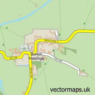
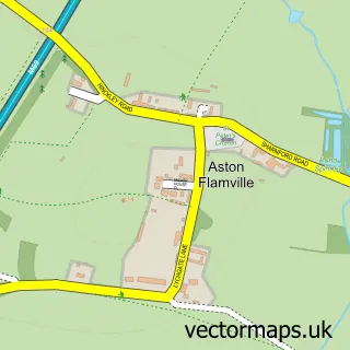
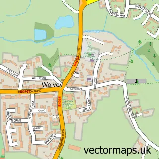
Nearby street map samples around Stretton Baskerville

More street maps in Leicestershire
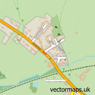
750 metre map area coverage
Boundary, postcode and point of interest information for the 750m x 750m rectangle centred on this sample map.
Boundaries containing map centre
Constituency: Hinckley and Bosworth Co Const
County: Leicestershire County
District: Hinckley and Bosworth District (B)
Icb: NHS Leicester Leicestershire and Rutland ICB
Parish: Burbage CP
Police Force: leicestershire
Postcode District: LE10
Postcode Sector: LE10 2
Ward: Burbage Sketchley and Stretton Ward
Nearby boundaries intersecting sample
Constituency: Rugby Co Const
County: Warwickshire County
District: Rugby District (B)
Icb: NHS Coventry and Warwickshire ICB
Parish: Stretton Baskerville CP, Wolvey CP
Police Force: warwickshire
Postcode Sector: LE10 3
Ward: Wolvey and Shilton Ward
Postcode coverage
POI category counts
Advertising Agency: 3
Beauty Salon: 3
Gas Station: 3
Bar: 2
Hotel: 2
Package Locker: 2
Pub: 2
Bakery: 1
Beauty And Spa: 1
British Restaurant: 1
Sample points of interest
- DBC Creative Agency
- Lumenautica
- Marine Lighting & Signage Lumenautica Ltd.
- West Cornwall Pasty Co
- Barnacles Restaurant & Bar Bistro
- Greene King Pub
- Katie Rose Aesthetics Nurse
- Beauty by Sharon
- Mia Rose Beauty
- Powder Brows by Carla
- Marco Pierre White Steakhouse Bar & Grill Hinckley
- Three Pots Post Office
Create a larger editable map of Stretton Baskerville
This sample shows only a 750 metre area. To create a larger map of Stretton Baskerville, use our map builder to choose your own coverage area, add titles and download editable SVG, PDF and PNG files.
Create a custom map of Stretton Baskerville