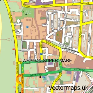
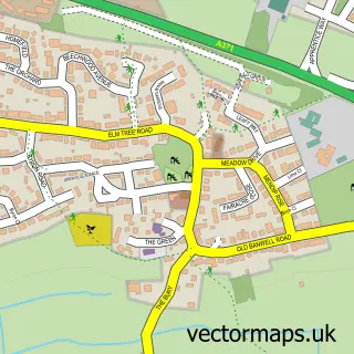
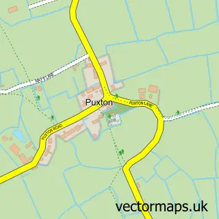
This Worle street map is a detailed vector street map covering a 750m x 750m area. Select a larger area to create and download your own vector street map of Worle.
The 750-metre map sample for Worle covers 642 mapped buildings and approximately 21.0 km of road detail, of which 53 named roads are named. The immediate area includes 2 schools, 1 GP surgery, with 4 within 2 miles, 6 pubs and 1 MOT station, with 16 within 2 miles. The wider area around Worle features 1 tourism point of interest, 13 food and drink venues and 4 campsites within 2 miles. To create a larger or custom map of Worle, the map builder lets you define your own coverage area and download editable SVG, PDF and PNG files.
Create a larger editable map of Worle
Choose any area you need and generate a high-quality vector map instantly. Perfect for print, planning, design, business and personal use.

This Worle street map in Somerset is available as downloadable SVG, PDF and PNG map files, or as a printed map for planning, business, display, education, local information and design work. You can also create a larger custom map area using the map selector.
What this Worle map sample shows
Worle lies within Weston-Super-Mare Cp parish, part of Weston-Super-Mare Kewstoke ward in the North Somerset local authority area. The postcode geography for this area includes the BS postcode area, the BS22 postcode district and the BS22 6 postcode sector. Residents fall under the Nhs Bristol, North Somerset And South Gloucestershire Integrated Care Board for NHS services.
Local features near Worle
Within 2 milesAmenities and services in and around Worle.
Administrative and postcode information for Worle
Worle lies within Weston-Super-Mare Cp parish, part of Weston-Super-Mare Kewstoke ward in the North Somerset local authority area. The postcode geography for this area includes the BS postcode area, the BS22 postcode district and the BS22 6 postcode sector. Residents fall under the Nhs Bristol, North Somerset And South Gloucestershire Integrated Care Board for NHS services.
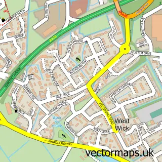
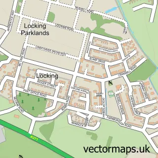
Nearby street map samples around Worle

More street maps in Somerset
750 metre map area coverage
Boundary, postcode and point of interest information for the 750m x 750m rectangle centred on this sample map.
Boundaries containing map centre
Constituency: Weston-Super-Mare Co Const
District: North Somerset
Icb: NHS Bristol North Somerset and South Gloucestershire ICB
Parish: Weston-Super-Mare CP
Police Force: avon and somerset
Postcode District: BS22
Postcode Sector: BS22 6
Ward: Weston-super-Mare Kewstoke Ward
Nearby boundaries intersecting sample
Postcode Sector: BS22 8, BS22 9
Ward: Weston-super-Mare Mid Worle Ward, Weston-super-Mare South Worle Ward
Postcode coverage
POI category counts
Hair Salon: 9
Real Estate Agent: 7
Barber: 6
Pub: 6
Real Estate: 6
Beauty Salon: 5
Grocery Store: 5
Automotive Repair: 4
Bank Credit Union: 4
Doctor: 4
Sample points of interest
- Hillmans Chartered Accountants
- Punch and Judy-Jack Edgar
- St Martin's
- St Martins Church
- Miller Farm
- Stanlya garden
- WSM Auction
- Meadows and Wood Hearing Care
- Everystep Financial
- AutoBliss Garage
- Coronation Garage
- Scaurs Garage
Create a larger editable map of Worle
This sample shows only a 750 metre area. To create a larger map of Worle, use our map builder to choose your own coverage area, add titles and download editable SVG, PDF and PNG files.
Create a custom map of Worle