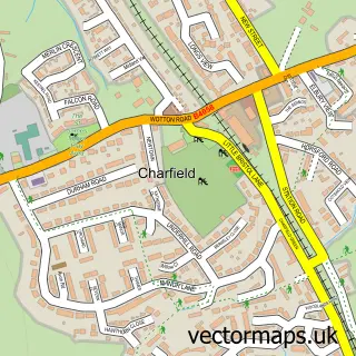
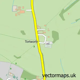
This Wotton-under-Edge street map is a detailed vector street map covering a 750m x 750m area. Select a larger area to create and download your own vector street map of Wotton-under-Edge.
The 750-metre map sample for Wotton-under-Edge covers 489 mapped buildings and approximately 17.1 km of road detail, of which 39 named roads are named. The immediate area includes 1 school, 1 GP surgery, with 2 within 2 miles, 3 pubs and 2 MOT stations, with 5 within 2 miles. The wider area around Wotton-under-Edge features 4 tourism points of interest, 9 food and drink venues and 1 hotel. To create a larger or custom map of Wotton-under-Edge, the map builder lets you define your own coverage area and download editable SVG, PDF and PNG files.
Create a larger editable map of Wotton-under-Edge
Choose any area you need and generate a high-quality vector map instantly. Perfect for print, planning, design, business and personal use.

This Wotton-under-Edge street map in Gloucestershire is available as downloadable SVG, PDF and PNG map files, or as a printed map for planning, business, display, education, local information and design work. You can also create a larger custom map area using the map selector.
What this Wotton-under-Edge map sample shows
Wotton-under-Edge lies within Wotton-Under-Edge Cp parish, part of Wotton-Under-Edge ward in the Stroud District local authority area. The postcode geography for this area includes the GL postcode area, the GL12 postcode district and the GL12 7 postcode sector. Residents fall under the Nhs Gloucestershire Integrated Care Board for NHS services.
Local features near Wotton-under-Edge
Within 2 milesAmenities and services in and around Wotton-under-Edge.
Administrative and postcode information for Wotton-under-Edge
Wotton-under-Edge lies within Wotton-Under-Edge Cp parish, part of Wotton-Under-Edge ward in the Stroud District local authority area. The postcode geography for this area includes the GL postcode area, the GL12 postcode district and the GL12 7 postcode sector. Residents fall under the Nhs Gloucestershire Integrated Care Board for NHS services.
Nearby street map samples around Wotton-under-Edge

More street maps in Gloucestershire
750 metre map area coverage
Boundary, postcode and point of interest information for the 750m x 750m rectangle centred on this sample map.
Boundaries containing map centre
Constituency: Stroud Co Const
County: Gloucestershire County
District: Stroud District
Icb: NHS Gloucestershire ICB
Parish: Wotton-under-Edge CP
Police Force: gloucestershire
Postcode District: GL12
Postcode Sector: GL12 7
Ward: Wotton-under-Edge Ward
Nearby boundaries intersecting sample
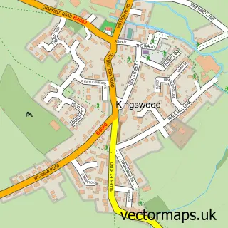
Parish: Kingswood CP
Postcode Sector: GL12 8
Postcode coverage
POI category counts
Flowers And Gifts Shop: 7
Real Estate Agent: 7
Coffee Shop: 4
Hair Salon: 4
Rental Kiosks: 4
Barber: 3
Clothing Store: 3
Doctor: 3
General Dentistry: 3
Pub: 3
Sample points of interest
- The Tolsey
- Amber Business Services Ltd.
- MGB Accountants
- Clarendon Press
- Plus One Design
- Clifford Davies
- Louise Megan Owen Osteopathy
- Break
- Cotswold Care Hospice Shop
- Ronald Shirley Chartered Architect
- PN Architecture Ltd
- Fish out of Water
Create a larger editable map of Wotton-under-Edge
This sample shows only a 750 metre area. To create a larger map of Wotton-under-Edge, use our map builder to choose your own coverage area, add titles and download editable SVG, PDF and PNG files.
Create a custom map of Wotton-under-Edge