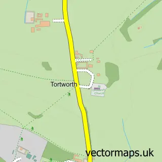
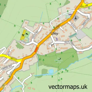
This North Nibley street map is a detailed vector street map covering a 750m x 750m area. Select a larger area to create and download your own vector street map of North Nibley.
The 750-metre map sample for North Nibley covers 118 mapped buildings and approximately 8.2 km of road detail, of which 6 named roads are named. The immediate area includes 3 GP surgeries within 2 miles, 1 pub and 5 MOT stations within 2 miles. The wider area around North Nibley features 4 tourism points of interest and 3 food and drink venues. To create a larger or custom map of North Nibley, the map builder lets you define your own coverage area and download editable SVG, PDF and PNG files.
Create a larger editable map of North Nibley
Choose any area you need and generate a high-quality vector map instantly. Perfect for print, planning, design, business and personal use.

This North Nibley street map in Gloucestershire is available as downloadable SVG, PDF and PNG map files, or as a printed map for planning, business, display, education, local information and design work. You can also create a larger custom map area using the map selector.
What this North Nibley map sample shows
North Nibley lies within North Nibley Cp parish, part of Wotton-Under-Edge ward in the Stroud District local authority area. The postcode geography for this area includes the GL postcode area, the GL11 postcode district and the GL11 6 postcode sector. Residents fall under the Nhs Gloucestershire Integrated Care Board for NHS services.
Local features near North Nibley
Within 2 milesAmenities and services in and around North Nibley.
Administrative and postcode information for North Nibley
North Nibley lies within North Nibley Cp parish, part of Wotton-Under-Edge ward in the Stroud District local authority area. The postcode geography for this area includes the GL postcode area, the GL11 postcode district and the GL11 6 postcode sector. Residents fall under the Nhs Gloucestershire Integrated Care Board for NHS services.
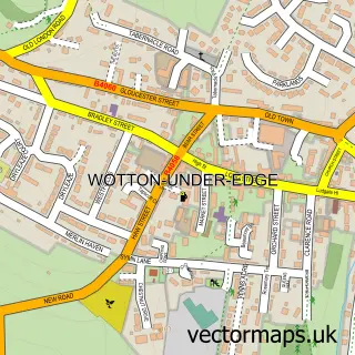
Nearby street map samples around North Nibley
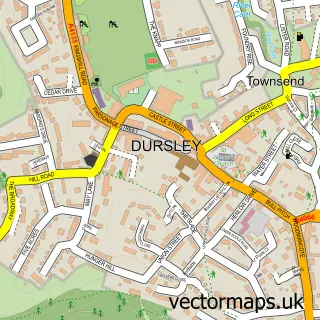

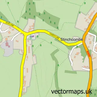
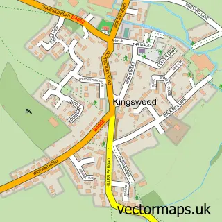
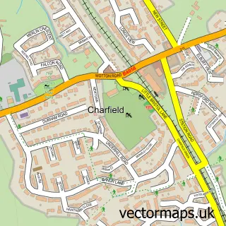
More street maps in Gloucestershire
750 metre map area coverage
Boundary, postcode and point of interest information for the 750m x 750m rectangle centred on this sample map.
Boundaries containing map centre
Constituency: Stroud Co Const
County: Gloucestershire County
District: Stroud District
Icb: NHS Gloucestershire ICB
Parish: North Nibley CP
Police Force: gloucestershire
Postcode District: GL11
Postcode Sector: GL11 6
Ward: Wotton-under-Edge Ward
Nearby boundaries intersecting sample
Postcode District: GL12
Postcode Sector: GL12 7
Postcode coverage
POI category counts
Professional Services: 3
Community Center: 2
It Service And Computer Repair: 2
Post Office: 2
Bed And Breakfast: 1
Building Contractor: 1
Campground: 1
Church Cathedral: 1
Coffee Shop: 1
Convenience Store: 1
Sample points of interest
- Road Green House
- Solar Soakers
- Valley Farm Camping
- North Nibley Chapel
- T & Cakes
- North Nibley Parish Council
- North Nibley Village Hall
- Post Office-North Nibley
- North Nibley C of E Primary School
- North Nibley C of E Primary School
- Timbrell P and S
- Bunny Clean
Create a larger editable map of North Nibley
This sample shows only a 750 metre area. To create a larger map of North Nibley, use our map builder to choose your own coverage area, add titles and download editable SVG, PDF and PNG files.
Create a custom map of North Nibley