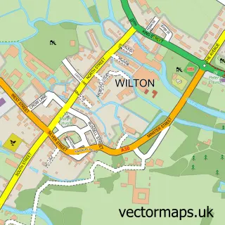
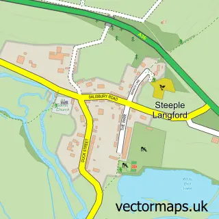
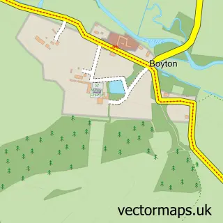
This Wylye street map is a detailed vector street map covering a 750m x 750m area. Select a larger area to create and download your own vector street map of Wylye.
The 750-metre map sample for Wylye covers 151 mapped buildings and approximately 7.2 km of road detail, of which 11 named roads are named. The immediate area includes 1 pub. The wider area around Wylye features 1 food and drink venue and 1 campsite within 2 miles. To create a larger or custom map of Wylye, the map builder lets you define your own coverage area and download editable SVG, PDF and PNG files.
Create a larger editable map of Wylye
Choose any area you need and generate a high-quality vector map instantly. Perfect for print, planning, design, business and personal use.

This Wylye street map in Wiltshire is available as downloadable SVG, PDF and PNG map files, or as a printed map for planning, business, display, education, local information and design work. You can also create a larger custom map area using the map selector.
What this Wylye map sample shows
Wylye lies within Wylye Cp parish, part of Till And Wylye Valley ward in the Wiltshire local authority area. The postcode geography for this area includes the BA postcode area, the BA12 postcode district and the BA12 0 postcode sector. Residents fall under the Nhs Bath And North East Somerset, Swindon And Wiltshire Integrated Care Board for NHS services.
Local features near Wylye
Within 2 milesAmenities and services in and around Wylye.
Administrative and postcode information for Wylye
Wylye lies within Wylye Cp parish, part of Till And Wylye Valley ward in the Wiltshire local authority area. The postcode geography for this area includes the BA postcode area, the BA12 postcode district and the BA12 0 postcode sector. Residents fall under the Nhs Bath And North East Somerset, Swindon And Wiltshire Integrated Care Board for NHS services.
Nearby street map samples around Wylye

More street maps in Wiltshire
750 metre map area coverage
Boundary, postcode and point of interest information for the 750m x 750m rectangle centred on this sample map.
Boundaries containing map centre
Constituency: Salisbury Co Const
District: Wiltshire
Icb: NHS Bath and North East Somerset Swindon and Wiltshire ICB
Parish: Wylye CP
Police Force: wiltshire
Postcode District: BA12
Postcode Sector: BA12 0
Nearby boundaries intersecting sample
No additional intersecting boundaries found.
Postcode coverage
POI category counts
Community Center: 2
Shipping Center: 2
Agricultural Service: 1
Alternative Medicine: 1
Anglican Church: 1
Bakery: 1
Driving School: 1
Pilates Studio: 1
Pub: 1
Train Station: 1
Sample points of interest
- JM Stratton & Co
- The Reiki School
- Wylye: St Mary the Virgin
- Mrs Wiltshire
- Wylye Village
- Wylye Village Hall
- Inspire Driving School
- Chapel Pilates and Yoga Studio
- The Bell Inn
- Post Office-Wylye
- Wylye Post Office
- Wylye railway station
Create a larger editable map of Wylye
This sample shows only a 750 metre area. To create a larger map of Wylye, use our map builder to choose your own coverage area, add titles and download editable SVG, PDF and PNG files.
Create a custom map of Wylye