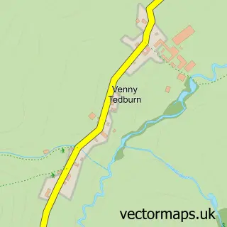
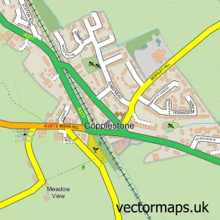
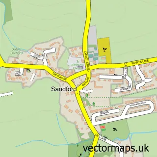
This Yeoford street map is a detailed vector street map covering a 750m x 750m area. Select a larger area to create and download your own vector street map of Yeoford.
The 750-metre map sample for Yeoford covers 101 mapped buildings and approximately 8.8 km of road detail, of which 5 named roads are named. The immediate area includes 1 school and 1 railway station. The wider area around Yeoford features 1 tourism point of interest and 1 hotel. To create a larger or custom map of Yeoford, the map builder lets you define your own coverage area and download editable SVG, PDF and PNG files.
Create a larger editable map of Yeoford
Choose any area you need and generate a high-quality vector map instantly. Perfect for print, planning, design, business and personal use.

This Yeoford street map in Devon is available as downloadable SVG, PDF and PNG map files, or as a printed map for planning, business, display, education, local information and design work. You can also create a larger custom map area using the map selector.
What this Yeoford map sample shows
Yeoford lies within Crediton Hamlets Cp parish, part of Yeo ward in the Mid Devon District local authority area. The postcode geography for this area includes the EX postcode area, the EX17 postcode district and the EX17 5 postcode sector. Residents fall under the Nhs Devon Integrated Care Board for NHS services.
Local features near Yeoford
Within 2 milesAmenities and services in and around Yeoford.
Administrative and postcode information for Yeoford
Yeoford lies within Crediton Hamlets Cp parish, part of Yeo ward in the Mid Devon District local authority area. The postcode geography for this area includes the EX postcode area, the EX17 postcode district and the EX17 5 postcode sector. Residents fall under the Nhs Devon Integrated Care Board for NHS services.
Nearby street map samples around Yeoford

More street maps in Devon
750 metre map area coverage
Boundary, postcode and point of interest information for the 750m x 750m rectangle centred on this sample map.
Boundaries containing map centre
Constituency: Central Devon Co Const
County: Devon County
District: Mid Devon District
Icb: NHS Devon ICB
Parish: Crediton Hamlets CP
Police Force: devon and cornwall
Postcode District: EX17
Postcode Sector: EX17 5
Ward: Yeo Ward
Nearby boundaries intersecting sample
No additional intersecting boundaries found.
Postcode coverage
POI category counts
Elementary School: 2
Train Station: 2
Advertising Agency: 1
Anglican Church: 1
Attractions And Activities: 1
Bar: 1
Building Supply Store: 1
Convenience Store: 1
Framing Store: 1
Hair Salon: 1
Sample points of interest
- Recognition Express South West
- Holy Trinity
- Yeoford Community Garden
- The Mare & Foal
- I S C A Preservation Ltd
- Yeoford Post Office
- Yeoford Community Primary School
- Yeoford County Primary School
- Acorn Fine Arts
- Opulent
- Sweetpeas Early Years Provision
- Brickmoor B & B Apartment
Create a larger editable map of Yeoford
This sample shows only a 750 metre area. To create a larger map of Yeoford, use our map builder to choose your own coverage area, add titles and download editable SVG, PDF and PNG files.
Create a custom map of Yeoford