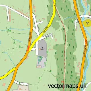
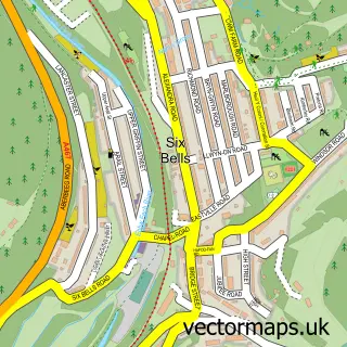
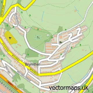
This Abersychan street map is a detailed vector street map covering a 750m x 750m area. Select a larger area to create and download your own vector street map of Abersychan.
The 750-metre map sample for Abersychan covers 314 mapped buildings and approximately 56.8 km of road detail, of which 24 named roads are named. The immediate area includes 1 school, 1 GP surgery within 2 miles, 1 pub and 8 MOT stations within 2 miles. The wider area around Abersychan features 1 tourism point of interest and 1 food and drink venue. To create a larger or custom map of Abersychan, the map builder lets you define your own coverage area and download editable SVG, PDF and PNG files.
Create a larger editable map of Abersychan
Choose any area you need and generate a high-quality vector map instantly. Perfect for print, planning, design, business and personal use.

This Abersychan street map in Gwent is available as downloadable SVG, PDF and PNG map files, or as a printed map for planning, business, display, education, local information and design work. You can also create a larger custom map area using the map selector.
What this Abersychan map sample shows
Abersychan lies within Abersychan Community parish, part of Abersychan ward in the Torfaen - Torfaen local authority area. The postcode geography for this area includes the NP postcode area, the NP4 postcode district and the NP4 8 postcode sector. Residents fall under the Aneurin Bevan University Health Board for NHS services.
Local features near Abersychan
Within 2 milesAmenities and services in and around Abersychan.
Administrative and postcode information for Abersychan
The local authority covering Abersychan is Torfaen - Torfaen, within the county of Gwent. The settlement lies within Abersychan ward and Abersychan Community civil parish. The NP4 postcode district and NP4 8 postcode sector serve the immediate area. NHS provision in the area is delivered through Aneurin Bevan University Health Board.
Nearby street map samples around Abersychan

More street maps in Gwent
750 metre map area coverage
Boundary, postcode and point of interest information for the 750m x 750m rectangle centred on this sample map.
Boundaries containing map centre
Constituency: Torfaen Co Const
District: Torfaen - Torfaen
Icb: Aneurin Bevan University
Parish: Abersychan Community
Police Force: gwent
Postcode District: NP4
Postcode Sector: NP4 7
Nearby boundaries intersecting sample
Postcode Sector: NP4 6, NP4 8
Postcode coverage
POI category counts
Contractor: 4
High School: 2
Automotive Repair: 1
Building Supply Store: 1
Computer Hardware Company: 1
Convenience Store: 1
Hair Salon: 1
Mountain: 1
Park: 1
Parking: 1
Sample points of interest
- Cwmffrwd Service Station
- The Dustbuster
- AJP Computing Ltd
- A J Lewis Builders
- LDW Tiling
- Plastercraft
- Storm Investigations
- Premier Abersychan Stores
- Being Beautiful
- Abersychan Comprehensive School
- Abersychan School
- Blaenavon Mountain
Create a larger editable map of Abersychan
This sample shows only a 750 metre area. To create a larger map of Abersychan, use our map builder to choose your own coverage area, add titles and download editable SVG, PDF and PNG files.
Create a custom map of Abersychan